Maptitude Geographic Information System (GIS) software is the intelligent mapping solution for business, government, and education. Maptitude is a powerful combination of software and geographic data that provides everything you need to realize the benefits of desktop mapping and spatial analysis with a single, easy-to-use package. Priced at only US$795, Maptitude is the best buy for those looking for mapping software.
In addition, Maptitude includes one FREE Country Package of your choice (a US$695 value). Choose the Brazil Country Package to get Brazil maps and detailed demographic data for census tracts and regions, municipalities, districts, subdistricts, and states.
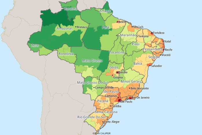
Maptitude mapping software for Brazil.
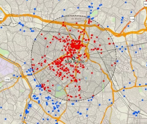
Locate your customers with Maptitude Brazil mapping software
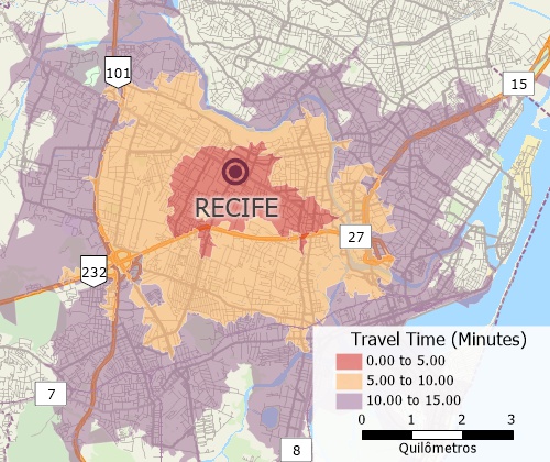
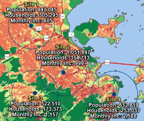
Perform drive-time analysis
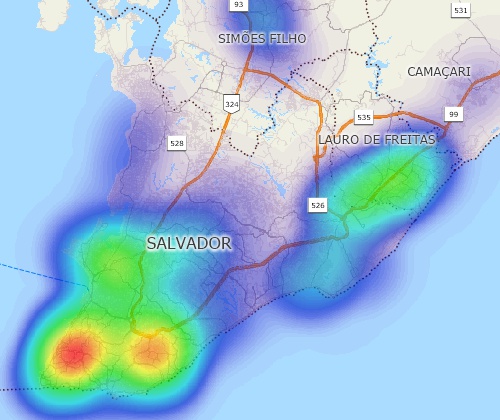
Visualize spatial patterns
The 2026 Brazil Country Package requires Maptitude 2026 or later and it is available to existing Maptitude users for US$695.

|
“I have worked with Caliper products for 10 years as a transportation/urban planner and they have always fulfilled my needs. Maptitude/TransCAD software are easy to use, organized and robust: able to cope with large datasets without any problems. The user interface is very clear and easy to understand. The exchange of data and databases across several formats is also very simple and functional.”
|
The Brazil Country Package for Maptitude includes extensive geographic and demographic data so that you can get started as soon as you install the software. The following geographic files are included:
| Nationwide HERE Brazil Geographic Data Layers |
|---|
|
| Other Included Brazil Data |
|---|
|
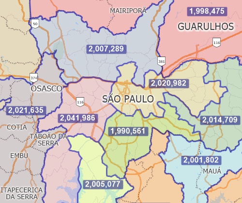
Create balanced territories
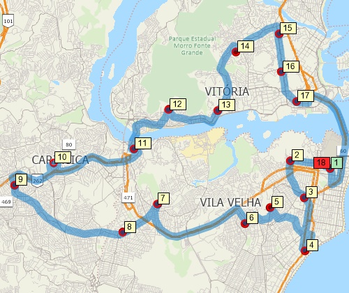
Find optimized routes serving multiple stops
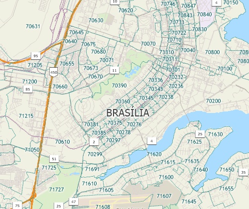
Includes nationwide postal areas
The Brazil Country Package includes Over 4000 fields of demographic data describing population, age, race, income, literacy, housing and more are included for the following geographic layers:
Over 400 fields of demographic data describing population, age, race, income, literacy, and housing are included for Census Tracts.
Includes demographics for regions down to statistical areas
Analyze locations with Maptitude Brazil map software
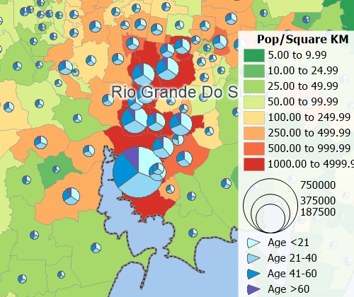
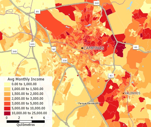
Create many types of thematic maps
For more information on Maptitude please visit the Maptitude Overview Page (English or Portugêse) or email a request for a live demo now.
Home | Products | Contact | Secure Store
