| Mapping, GIS, & Transportation Software Solutions |
| Mapping, GIS, & Transportation Software Solutions |
NEWTON, MASSACHUSETTS (USA) - Caliper Corporation is launching a new mapping solution for businesses and organizations around the world. Developed in response to the demand for a simple product to create and analyze maps and geographic information, Maptitude 2012 provides access to location-based data and analysis, quickly and easily and for many countries.
Maptitude 2012 is a major release. The features and enhancements (More...) enable you to create the maps you need faster, with higher accuracy, more attractively, and with better analytics. Maptitude 2012 has powerful tools and detailed demographics that enable organizations to leverage their data to improve location-based customer and business management.
If you have national or global customers and assets, the new Maptitude Country Packages allow you to support your domestic and international mapping requirements. Maptitude ships with one Package of your choice, and additional countries can be purchased separately. When you can switch between the countries you have purchased, Maptitude seamlessly refreshes the interface with country-specific tools such as those for finding, pin mapping (geocoding), routing, and the Create-a-Map Wizard. Also, new Map Libraries allow you to easily create presentation quality geographic and demographic maps, and you can locate unlimited numbers of addresses and territory-based records.
Each Country Package has access to an up-to-date map database allowing address locating and street visualization plus robust data on which to calculate driving routes and travel time rings. Also included are building footprints for many urban locations, railroads, and named landmarks that range from public facilities to commercial buildings such as shops, restaurants, and retail stores. Also shipped are postal data and, where available, population statistics.
The Maptitude 2012 United States Package has the most accurate data and demographics ever included and provides direct access to 2010 Census Data. The Census is the only reliable source for nationwide demographics such as income, population, race, age, ethnicity, households, and housing units. The 2010 Census and American Community Survey (ACS) data are supplied with U.S. Census Tract boundaries, Counties, MSAs, MCDs, States, and ZIP Codes. If you make business decisions based on postal data, Caliper ZIP Codes ensure you are using high quality nationwide information.
Maptitude ships with one country of your choice (currently the U.S.A., Canada, United Kingdom, Mexico, Australia, or New Zealand), and additional Country Packages can be purchased for US$695 as they become available.
Maptitude is unique in the marketplace for the provision of comprehensive data and functionality in a single product for a single low price. Maptitude remains the most competitively priced professional mapping software available. If you have any questions about our product suite please call Maptitude Sales (USA) at +1 617-527-4700, or send an e-mail to sales@caliper.com.
Caliper Corporation develops state-of-the-art Geographic Information Systems (GIS) software. With a focus on usability, Maptitude is designed to be a cost-effective, professional mapping software product. Maptitude enables organizations to leverage their location-based data to improve decision making and planning, while minimizing expenditure through competitively priced solutions.
Caliper is a privately held corporation and is a leading developer of mapping, redistricting, transportation, and GIS software.
Geocode your data with street level detail within each country package.
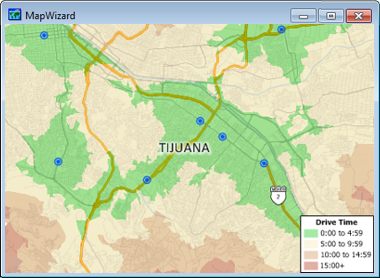
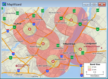
Detailed street information includes distances, drive-times, and one-way streets for creating accurate drive-time bands or routes.
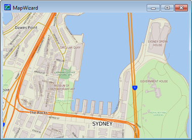
Each country contains detailed geography including landmarks and building footprints in many urban areas.
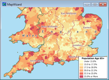
Population statistics are included where available.
Home | Products | Contact | Secure Store