Maptitude Help / Geographic Analysis Tools
Geographic Analysis Tools
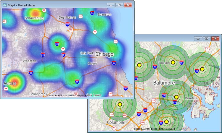
One of the best reasons to use a GIS is that you can perform geographic computations that help you in your work. The table below shows what you can do with the geographic analysis tools included with Maptitude:
| Tool | Use it to... |
|---|---|
 Measure Distance Measure Distance |
Measure the distance between locations |
 Measure Size Measure Size |
Measure the size of areas |
 Measure Angle Measure Angle |
Measure angles |
 Buffers Buffers |
Create buffers/bands/rings around map features |
 Buffers Toolbar Buffers Toolbar |
Add temporary features to a map and create buffers around them |
 Density/Heat Layer Density/Heat Layer |
Visualize point data on a regular grid as a heat map |
 Facility Location Facility Location |
Determine preferred facility locations from a set of candidates |
 Market Share (Huff Model) Market Share (Huff Model) |
Calculate market share versus your competitors |
 Tag Points by Area Tag Points by Area |
Tag points to the area to which they belong |
 Territory Manager Territory Manager |
Create territories or districts by combining smaller areas |
 Straight Line Influence Areas Straight Line Influence Areas |
Define areas of influence/catchment areas for a set of points |
 Weighted Center Weighted Center |
Create a circular service area based on a set of points and locate its weighted center |
 Desire Lines Desire Lines |
Create desire lines to show flows from point to point |
 Overlay Overlay |
Estimate the attributes of features by overlaying them on another layer |
Data created with these processes can also be used for further analysis and decision making.
©2026 Caliper Corporation