Maptitude Geographic Information System (GIS) software is the intelligent mapping solution for business, government, and education. Maptitude is a powerful combination of software and geographic data that provides everything you need to realize the benefits of desktop mapping and spatial analysis with a single, easy-to-use package.
Maptitude with the Europe Country Package is the best buy for those needing to create detailed maps and analysis in the Netherlands and elsewhere in Europe.
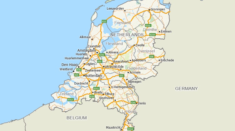
Maptitude mapping software for Netherlands
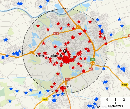
Locate your customers with Maptitude Netherlands mapping software
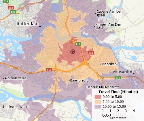
Perform drive-time analysis
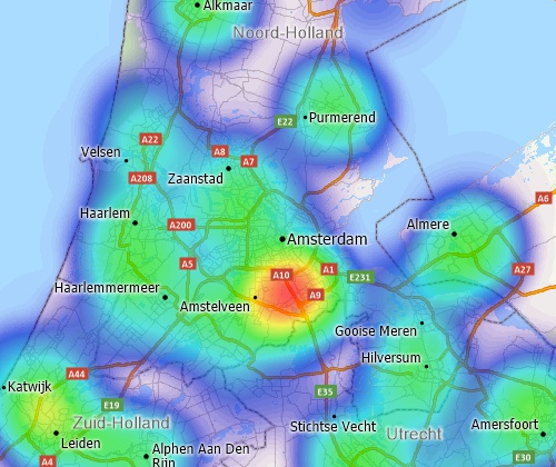
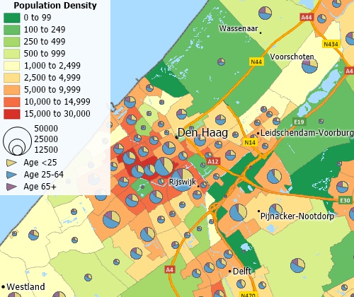
Visualise spatial patterns

|
“Maptitude adds features and enhanced capabilities, that make it a continued pleasure to work with. Even after years of use I come across new options that allow for quality analysis. Frequently now, I apply the facility location tool, which offers outstanding opportunities to relocate warehouses or stores. Used creatively, for instance in Service Logistics engineer allocation projects, finding the right location for a pudo or dropbox location is a breeze with this tool. Multiple scenarios can be calculated and analysed, and the results integrated in Excel- or Power BI models. Maptitude continues to deliver complemented with outstanding support and training.”
|
The Europe Country Package for Maptitude includes extensive geographic data so that you can get started as soon as you install the software. The following geographic files are included:
| Nationwide HERE Europe Geographic Data Layers |
|---|
|
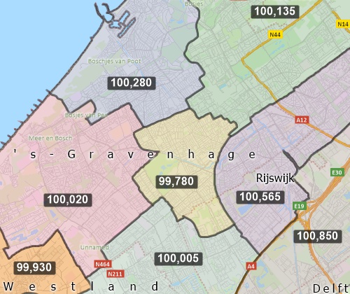
Create balanced territories
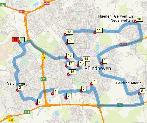
Find optimised routes serving multiple stops
Create many types of thematic maps
For more information on Maptitude please visit the Maptitude Overview Page or email a request for a live demo now.
Email Caliper or call +1 617-527-4700 for pricing information.
Home | Products | Contact | Secure Store
