Maptitude is a ground-breaking mix of analytics and geographic information that gives you all that you will need to perform location-based planning and geographic analysis in a single, simple to-utilize bundle. Maptitude lets you make maps utilizing your own information so that you can improve your understanding of the geographic elements that are inherent to your business data.
Maptitude has unlimited geocoding and directions and can place your points on a map or create routes in batches. Maptitude can calculate directions and routes with no Internet connection and displays offline maps. You also have full control over how the map looks.
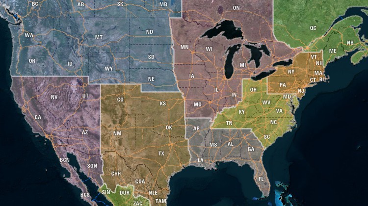
Build custom territories with Maptitude alternative to Google Maps
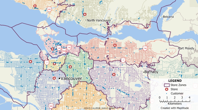
Maptitude can create territories based on drive-time making it an ideal alternative to Google Maps
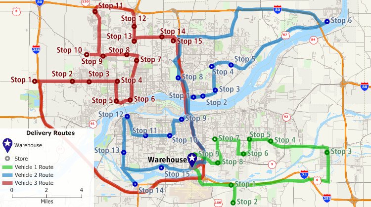
Vehicle routing with time windows, vehicle constraints, multiple depots, route length constraints, and mixed pickup and delivery are all possible with Maptitude alternative to Google Maps
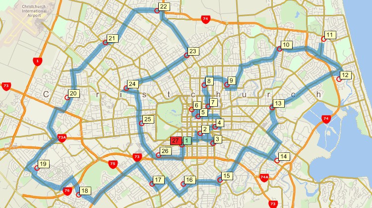
Optimize delivery routes with Maptitude Google Maps alternative
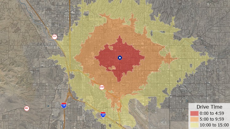
Compute drive-time rings with Maptitude Google Maps replacement
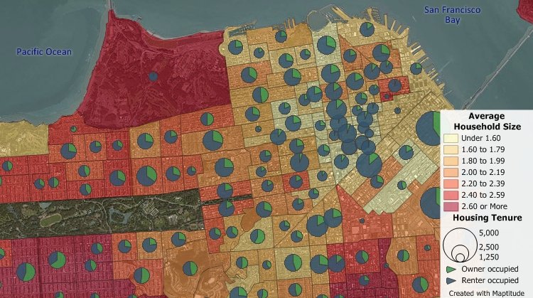
Maptitude includes the latest demographic to enable you to better analyze and understand details hidden in a Google Map
Maptitude makes it possible to export a map to a variety of file formats such as Google Maps KML and KMZ. When you export to Google Maps, Maptitude exports your locations and tabular data and also applies the styles that you chose in Maptitude.
Maptitude can use web service providers such as Google maps, HERE map, or Bing Maps to map real-time travel times between different locations. You can then use your origins and destinations to create a table of the shortest routes between them. Maptitude can also calculate travel times between your locations without using Google and has no limit on how many routes you can analyze.
 |
“Maptitude is the best deal in the GIS world for users who need or could need – and might not know it yet - full GIS functionality but have a restricted budget and little time for training. I have taught GIS software of several vendors for almost 20 years for use in public health. Of the 3 or 4 most important packages Maptitude is definitely the easiest to use and compared to others, inexpensive. I cannot think of a GIS operation that it cannot do and in fact most operations which are complicated especially for beginners are almost simple in Maptitude. It is a package that one can learn on one’s own. The on-line user manual is the best in the business and on the Caliper.com site there are lots of very well done instructional videos. It comes with a lot of world data and a very complete suite of U.S. datasets. But there is a version for the United Kingdom, also Australia, Brazil, several more. Also it has a very nice interface with Google map. You can make professional quality maps right out of the box. Of course what you want to map is your own data and doing that while using the provided base maps makes for a very complete and sophisticated spatial analysis package.”
|
 |
“I have worked with Caliper products for 10 years as a transportation/urban planner and they have always fulfilled my needs. Maptitude/TransCAD software are easy to use, organized and robust: able to cope with large datasets without any problems. The user interface is very clear and easy to understand. The exchange of data and databases across several formats is also very simple and functional. The two-way direct link with Google Earth makes my projects look really interesting.”
|


Maptitude |
The best mapping software and Google Maps replacement! Here's why:√ Maptitude is the easiest-to-use full featured mapping software, and includes powerful tools such as multi-ring drive-time zones √ Maptitude has no subscription fees, and supports secure off-line data storage
√ Maptitude provides fully customizable maps with unlimited point icons √ Maptitude has unlimited pin-mapping/geocoding √ Maptitude includes free mapping data and demographics covering everything from population statistics to business locations, postal/ZIP Codes, and more! |
 Check out our G2 Reviews
Home | Products | Contact | Secure Store