A mapping software such as Maptitude supports the analysis, and data collection and data management, of information related to military logistics and defense intelligence. Mapping tools are very useful for seeing patterns in such data and in providing analytical tools that help you visualize and understand how to improve planning and logistics.
A GIS can be used in any wing of the military. For example:
You can then share and export your results directly from within the mapping application.
Maptitude terrain analysis tools allow you to:

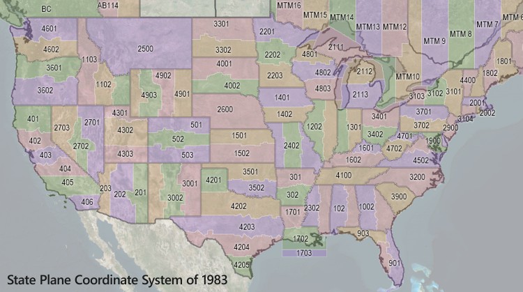
Geographic data can be stored in many ways, including some that don’t fit neatly into a defined coordinate system. Maptitude includes two advanced features that help you use geographic data from almost any source:
Maptitude stores the data in its geographic files in degrees of longitude and latitude. Maptitude lets you shift and scale the coordinates in an arbitrary coordinate system so that they match up with coordinates in a standard coordinate system. This way, Maptitude can correctly convert the data and store it in degrees of latitude and longitude. You can also convert Maptitude data so it can be used in your arbitrary coordinate system.
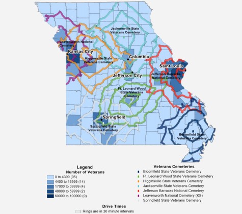
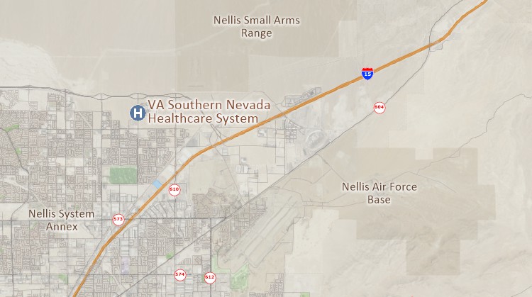
Assess access to veterans' services such as veterans' homes, cemeteries, and hospitals.
Example: Missouri Veterans Commission Veterans' Needs Feasibility Study
Maximize the value of fiscal resources obligated to service contracts.
Example: An Analysis of Category Management of Service Contracts
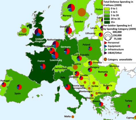
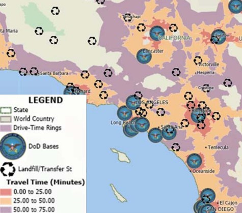
Study defense budgets and spending, troop deployment, and regulatory frameworks.
Example: European Defense Trends
 |
“We explored numerous commercially available software options typically utilized for business analysis functions. One of the best contenders was the Maptitude Geographic Information Software (GIS). Maptitude GIS is robust, easy-to-use, professional business mapping software that businesses use for in-depth geographic analysis of demographic data to make data-driven decisions.” Austin Clark & Corey M. Arruda |
Request a demo or download a trial of Maptitude to see how visualizing military data can benefit your organization!
Home | Products | Contact | Secure Store