Council Redistricting Software - Redrawing Council Districts
Council redistricting is a complex process incorporating input
from a wide variety of stakeholders. For Council redistricting,
often a districting commission for the city must use criteria in
determining the city council lines such as:
- Population. The difference between the most populous and
the least populous council district must not exceed a
percentage of the average population for all council
districts.
- Fair and effective representation. The redistricting
plan must be established in a manner that ensures the fair
and effective representation of the racial and language
minority groups in the city.
- Communities of Interest. District lines should keep
intact neighborhoods with established ties of common
interest and association, whether historical, racial,
economic, ethnic, religious or other.
- Compactness. Each district must be compact, e.g., each
district cannot be more than twice as long as it is wide.
- Contiguity. Each district must be contiguous, and
whenever a part of a district is separated from the rest of
the district by a body of water, there must be a connection
by a bridge, a tunnel, a tramway, or regular ferry service.
- Political boundaries. A district cannot cross local or
county boundaries.
This is why Caliper developed
Maptitude for Redistricting.
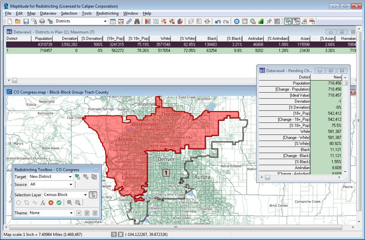
Redrawing council districts with Maptitude for Redistricting
Maptitude for Redistricting is the ultimate in redistricting
software. It is used by a majority of the state legislatures,
redistricting commissions, political parties, and public
interest groups. A web-based version, Maptitude
Online Redistricting, is suitable for individual citizens and
legislators who wish to propose boundaries for their district or
even an entire plan. There is also a version that
runs as an extension
to ArcGIS if you prefer working in that GIS environment.

|
“It's light years ahead.
The software can do so much more, so much more quickly.”
Karl Aro
Director, Maryland Dept. of Legislative Services
|
Maptitude is the perfect solution for adding additional GIS
users where Esri software is already in use. Maptitude:
Map Esri Shapefiles, Geodatabase, and more...
- Integrates with other vendor products by
supporting formats such as Esri shapefiles, Esri
geodatabases, and Esri ArcMap maps (more...)
- Has lower costs, lower barriers to use, and a lower
learning curve
- Can be installed and used within minutes of receiving a
download of the software
- Has low IT support needs as an MS Office style
application
- Has low ongoing costs (one-off pricing with optional
annual upgrades)
- Is commonly used where there is already an Esri
installation
To learn more about the city council redistricting features in
Maptitude for Redistricting, please see
the Features page or contact Caliper Sales at
sales@caliper.com
or by phone at 617-527-4700.
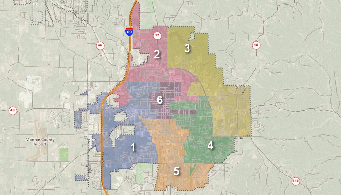
City council redistricting
City Councils Using Maptitude for Redistricting (Partial List):
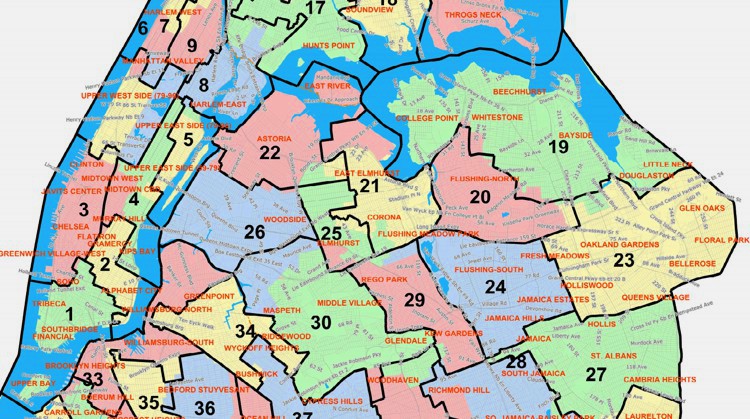
 CASE STUDY: NYC Board of Elections
Redrawing lines due to reapportionment
Mapping council districts with Maptitude for Redistricting
Maptitude redistricting software solutions:
 Check out our G2 Reviews