|
January 2017 Newsletter |
|||
|
|||


Website | Contact Us | Pricing | Live Demo | Free Trial | Reviews
You will quickly find the cost savings & opportunities hidden in your data
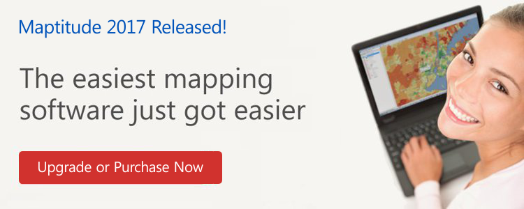
The Maptitude 2017 menu system redesign emphasizes user workflow. The new yet familiar interface streamlines the map making process. Consistent terminology, logical feature groupings, and direct access to critical tools result in a vastly improved user experience that builds on the reputation of Maptitude as the easiest to use professional mapping system. Creating maps and visualizing your data is easier than ever before with Maptitude 2017.

DATA
New U.S. data sets provide access to the
most up-to-date geographic information available.
More...
LOGISTICS & OPERATIONS
A new distance and drive-time
tool creates an Excel table that lists the costs of travel between
any number of origins and destinations. You can now quickly identify
the closest and backup locations ranked by travel time or distance.
More...
SHARING
Maptitude dominates the space vacated
by the discontinued Microsoft MapPoint. Maptitude 2017 now supports
MapPoint territory files (*.ptm, *.est, *.axe) that do not have data
columns or that have County and State information in separate
columns.
More...


Featured Map
New Maptitude 2017 Telephone Area Code Layer for the USA and Canada
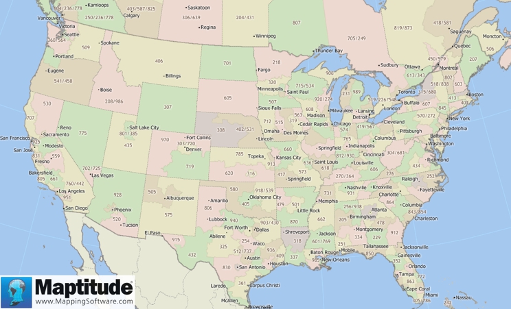
This month's featured map shows the new telephone area code layer included with Maptitude 2017. This layer can be accessed via Map > Demographic Map Librarian and then choosing Area Code Boundaries in the Overview Maps category.
Tech Tip
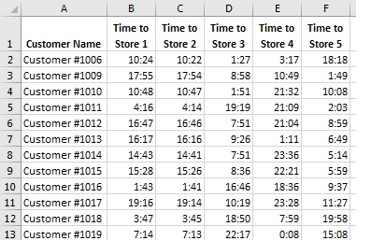
How do I identify multiple nearby locations for multiple origins?
|
|
Maptitude 2017 makes it easy to identify alternative service suppliers, backup field representatives, and the closest locations. The new Distance and Travel Times Tables tool allows you to choose a layer of origins and destinations and calculates the distance or time taken to travel between them. For example, using a point layer of stores and a separate point layer of customers you could create a table of the drive times to the various stores for each customer. Alternatively, you can use selection sets of origins and destinations from a single point layer. The results can be viewed in Excel or Maptitude, allowing you to easily sort the table to identify the closest locations. This Tech Tip shows how to work with the Distance and Travel Times Tables tool in Maptitude 2017. |
Tricks & Tips
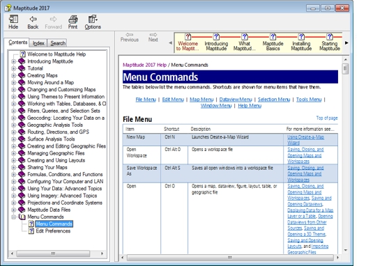
Where is the list of Maptitude 2017 menu items with a description of each?
|
|
Maptitude 2017 has a reorganized menu system. The Maptitude Help (choose Help-Maptitude Help) has a listing of every menu item and what it does. The topic is "Menu Commands" and it is the last branch under Contents, as shown in the screenshot. Maptitude 2017 has also added a Windows Microsoft Office style question mark icon to most windows. Clicking the question mark will take you to the relevant section of the Help. You can also hover over any menu item and click F1 to access Help topics. |
Learning
Free MapPoint Webinar, Video, & Handout Now Available! UK and US Training Dates!

|
|
MapPoint Webinar: This webinar will help MapPoint users new to Maptitude 2017. We will discuss mapping your data, changing the styles on a map, getting reports on custom-defined areas, creating drive time rings, the hover label tool and creating territories. There is also a free class handout here. |