Maptitude Geographic Information System (GIS) software is the intelligent mapping solution for business, government, and education. Maptitude is a powerful combination of software and geographic data that provides everything you need to realize the benefits of desktop mapping and spatial analysis with a single, easy-to-use package. Priced at only US$795, Maptitude is the best buy for those looking for mapping software.
In addition, Maptitude includes one FREE Country Package of your choice (a US$695 value). Choose the Canada Country Package to get Canada maps and detailed demographic data for Provinces, Tracts, Federal Election Districts, FSAs, Census Metropolitan Areas, Census Divisions, and Census Subdivisions.
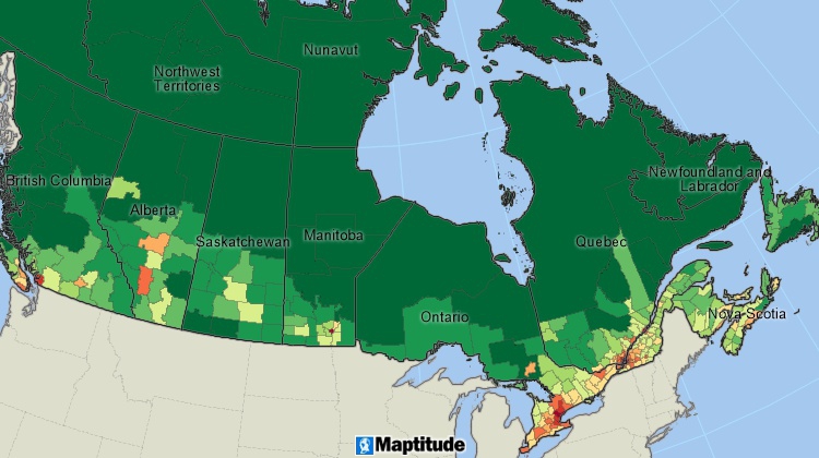
Maptitude mapping software for Canada.
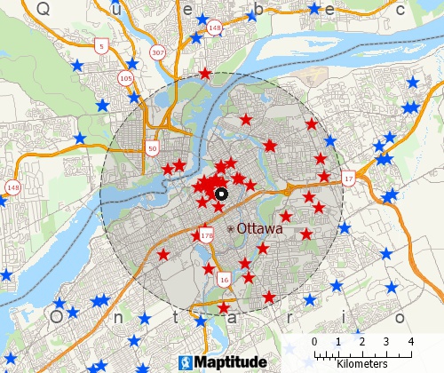
Locate your customers with Maptitude Canada mapping software
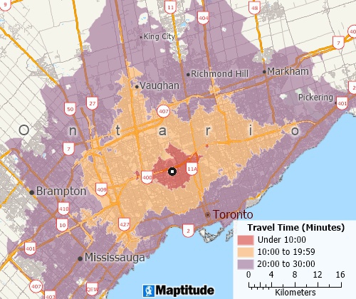
Perform drive-time analysis
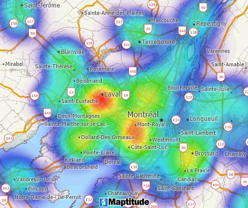
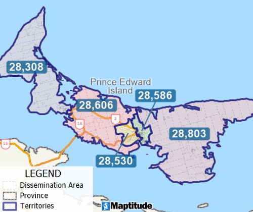
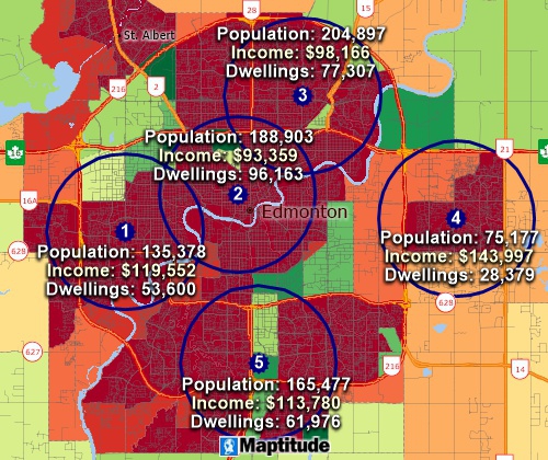
Visualise spatial patterns
The 2026 Canada Country Package requires Maptitude 2026 or later and it is available to existing Maptitude users for US$695.

|
“Tried Maptitude out looking for a simple mapping software, and got so much more. Definitely worth the purchase. The support team is above par and are always available for any question.”
|
 |
“I have used Maptitude for years for my franchising business. The Maptitude platform has given me everything I need, and any time I have needed tech support the team always responds quickly. I would highly recommend.”
|
The Canada Country Package for Maptitude includes extensive geographic and demographic data so that you can get started as soon as you install the software. The following geographic files are included:
| Nationwide HERE Canada Geographic Data Layers |
|---|
|
| Other Included Canada Data |
|---|
|
Create balanced territories
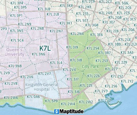
Map by area using 6-digit Canadian postcodes
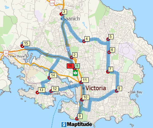
Find optimised routes serving multiple stops
Almost 1300 fields of demographic data from the 2021 Census describing population, dwellings, age, marital status, family characteristics, language spoken, income, source of income, immigration, minority, ancestry, religion, education, employment, mode to work, occupation, and housing are included for the following geographic layers:
The following layers also contain more limited demographic data:

|
“Quite the best mapping experience I had....Without disclosing anything, I mapped where our customers (in terms of longevity) were churning. Therefore, I had a great idea where competitors were 'attacking.' Putting it on a map made it easier, especially when you have an enormous data set.”
|
Includes demographics to the Tracts and Subdivision level
Analyse locations with Maptitude Canada map software
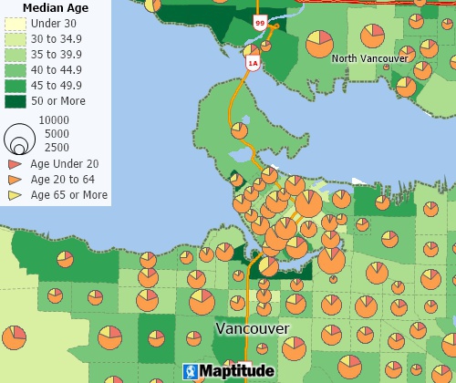
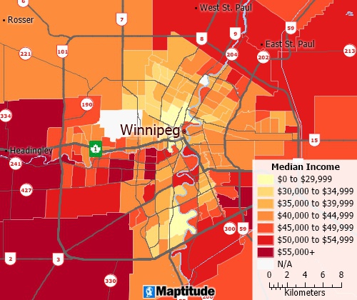
Create many types of thematic maps
Business Mapping Software Canada
Enterprise GIS Software Canada
Franchise Mapping Software Canada
For more information on Maptitude please visit the Maptitude
Overview Page (English or
French) or email a request
for a
live demo now.
Home | Products | Contact | Secure Store
