Maptitude can map the resources needed for community groups and businesses to do environmental justice research or Risk Management Planning (RMP) and to explore, communicate, and compare toxic hazards using maps and a GIS (geographic information system).
Communities and organizations across the USA can acquire the Maptitude software and immediately map the latest Census demographics. The EPA advises that you use the current Census data, but as of October 2022, MARPLOT does not include the 2020 Census data. Maptitude includes the current 2020 Census data and annually updated ACS data.
Maptitude includes many choices for map backgrounds, and comes with streets, demographics, streams, Census Tracts, and more, including:
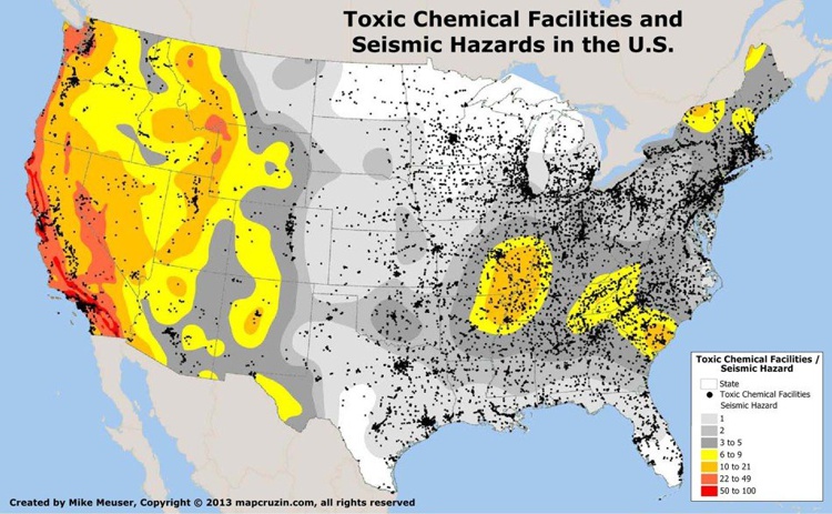
Map of chemical facilities and seismic hazards created with Maptitude risk management software, a MARPLOT replacement

|
“Maptitude includes Census, ACS, and FFIEC income data that saves us many hours of searching, selecting, downloading, sorting and combining data.”
|
Most toxic data is available for download from the government and can be mapped in Maptitude using one of the largest native file format libraries available. These include:
Maptitude Online can be used to easily publish and share your maps and research, and for others to explore your regulatory compliance results.
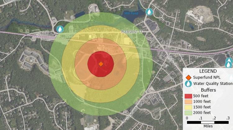
Maptitude risk management planning softare alternative to MARPLOT
Home | Products | Contact | Secure Store

 EXAMPLES: