A map radius tool allows you to create custom radius maps with only a few clicks. You can immediately create an Excel report for your location that describes the demographics and locations within your search distance.
Maptitude is a powerful and accurate radius mapping tool that lets you draw a radius on a map with ease. Whether you're planning routes, analyzing markets, or conducting boundary analysis, Maptitude offers unmatched flexibility and precision.
With Maptitude Radius Mapping Software, you can:
Maptitude includes the most accurate ZIP Code and street data available, allowing for better business decisions than relying on spreadsheets alone. You can export your radius maps to:
Maptitude also offers consulting services for custom radius map creation and includes a robust mile radius calculator to determine proximity or travel costs between locations: features that go far beyond the basic "measure distance" tool found in apps like Google Maps.
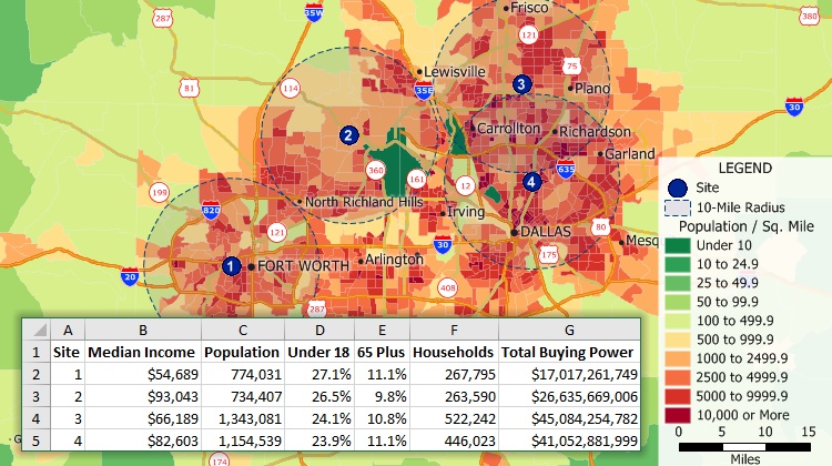
Create radius maps around one or more locations and estimate the populations within those radii
This interactive map lets you see draw a circle of any radius. See the hospitals within any radius of any location in the U.S.
To save your radius map, add your own markers/locations in bulk, and much more, try the full-featured version of Maptitude with a 1-month risk-free trial. No credit card is required. Get access to map radius tools, drive time radius tools, and many more advanced features by signing up for a free trial today!
Map radius tools allow users to create and visualize maps of geographical areas based on a specified radius or distance from a central point. ZIP Code radius maps are an excellent way to explore and show market and trade areas.
You can also create driving radius maps showing the fastest time rings or the shortest distance rings. Use these maps to identify how far customers are willing to travel to your stores or to find locations that are underserved by emergency services.

|
“Affordable, easy to use, but powerful”“I work in Real Estate market analysis. Maptitude has many tools for demographic and location analysis. I can pull population data within drive bands, radius, or various other ways. I create awesome visual maps that clients love. I have also done little more complex retail gravity huff model for regional shopping centres.” Matt Myers |
Radius mapping tools help businesses visualize location-based data to uncover patterns, inform strategy, and make smarter decisions. By analyzing the area around a specific point—such as a store, warehouse, or customer location—organizations can unlock powerful spatial insights.
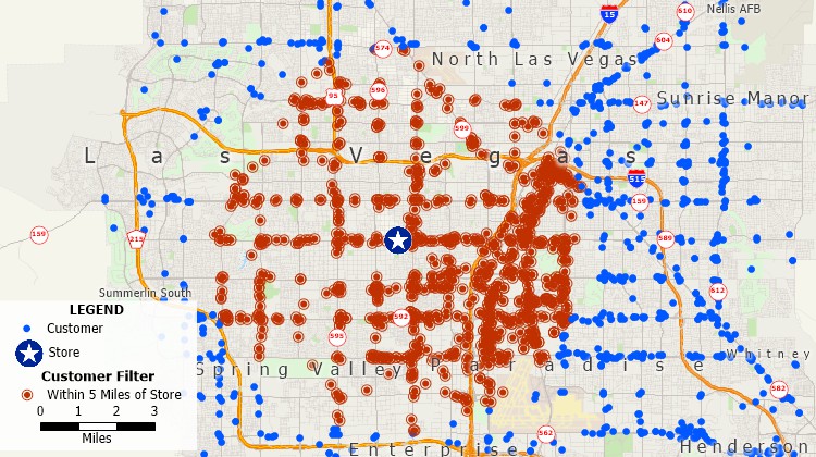
Filter map features by radius
There are three types of radius map:
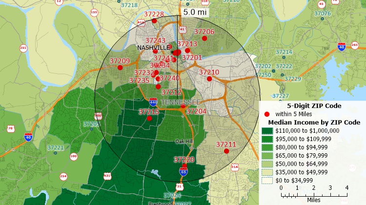
Use the Maptitude map radius tool to create ZIP Code radius maps - identify the ZIP Codes and demographics within any radius
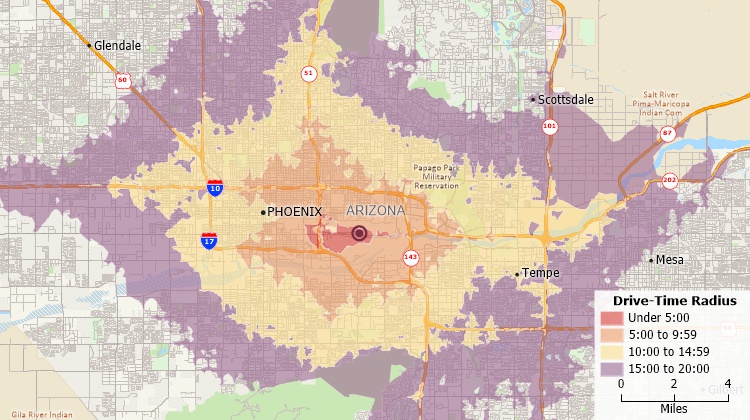
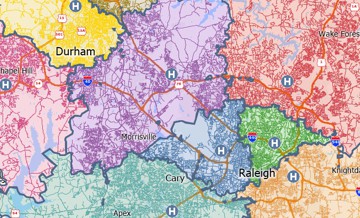
A driving radius map can show driving distance or time rings around a location
Radius maps show circle-shaped features to indicate the distance from a central point. Examples include choropleth heat maps, which show the intensity of an area in relation to the distance from the central point, and population density maps, which show how many people live within a certain radius.
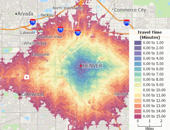
A drive time radius map with a heat style
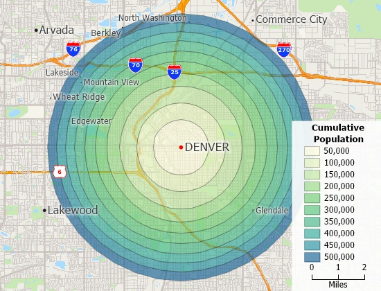
A radius map shaded by cumulative population per ring
A map radius calculator makes it easy to find alternative service providers, backup field representatives and the nearest locations. The calculator determines the closest sales representative to each customer or the closest vendor for each store. If the nearest location is not available for reasons such as low inventory or temporary outages, you will quickly be able to choose the alternate nearest suppliers. The results are provided in a table format.
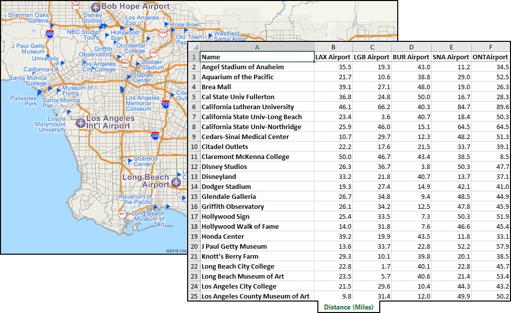
The map radius calculator identifies the distance to locations from one ore more central locations
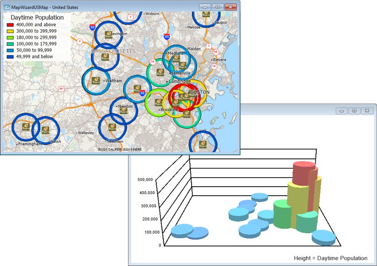
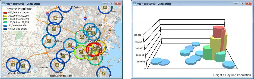
Create color and 3D map themes illustrating radius data with the Maptitude radius mapping app
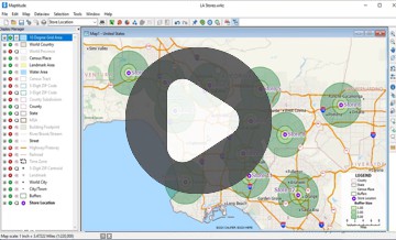
Watch a tutorial video on creating circular buffers with Maptitude
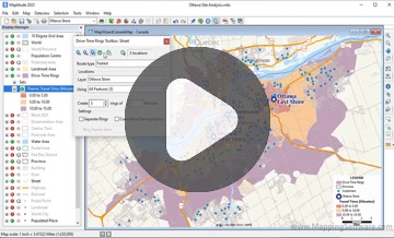
Watch a tutorial video on creating drive-time rings with Maptitude
To print and measure a radius map, you will need to follow these steps:
It is also possible to create a radius map manually by drawing it on a blank map or paper. To do this, you will need to use a ruler or other measuring tool to mark the radius around the center point and draw the map by hand.
Request a demo of Maptitude to see how you and your team can use radius mapping software to better understand your data!


Home | Products | Contact | Secure Store