| Mapping, GIS, & Transportation Software Solutions |
| Mapping, GIS, & Transportation Software Solutions |
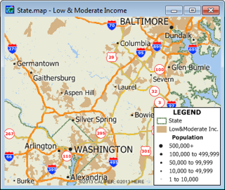
The Low and Moderate Income Area file contains the boundaries for all the areas that are classified as being predominantly Low and Moderate Income, using 2000 Census figures. Each area is defined by a collection of census block group pieces. In general, at least 51% of the residents must be of low or moderate income for a census block group piece to be so classified. However, specific urban areas fall under an exception that lowers the threshold. The threshold percentage is included in the data.
Available in Caliper CDF format for use with Maptitude and TransCAD. To learn about data availability in other GIS file formats, please contact a Caliper data expert today by emailing sales@caliper.com or by calling us at +1 617-527-4700.
To order or learn more, please contact a Caliper data expert today by emailing sales@caliper.com or by calling us at +1 617-527-4700.
*For use with a single copy of Caliper's Maptitude Mapping Software or TransCAD Transportation Planning Software

Home | Products | Contact | Secure Store