| Mapping, GIS, & Transportation Software Solutions |
| Mapping, GIS, & Transportation Software Solutions |
Point layers of all signed and numbered highway exits and interchanges are available for Maptitude users who are also licensed to use the USA or Canada Country Packages*. Highway exit data provides some of the key information needed to evaluate sites for network accessibility based on proximity to major highways and interchanges.
Highlights:
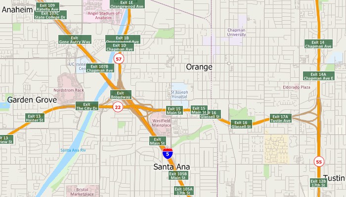
Maptitude map with U.S. highway exit and interchange layer
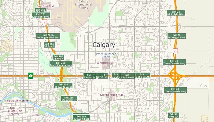
Maptitude map with Canada highway exit and interchange layer
Available in Caliper CDF format for use with the latest version of Maptitude and TransCAD. To learn about data availability in other GIS file formats, please contact a Caliper data expert today by emailing sales@caliper.com or by calling us at +1 617-527-4700.
*Requires latest Maptitude or TransCAD license and USA or Canada Country Package
Home | Products | Contact | Secure Store