| July 2025 Newsletter |

|

|
| Website | Contact Us | Pricing | Live Demo | Free Demo | Reviews | |
|
Maptitude 2025: New Territory Management Tools 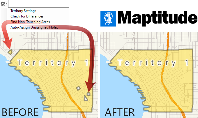
What's the story?
Why is this important?
Whether you're managing sales teams, service regions, or delivery routes, Maptitude 2025 gives you the tools to create and maintain effective territories with confidence. |
||||||||||
|
||||||||||
|
||||||||||
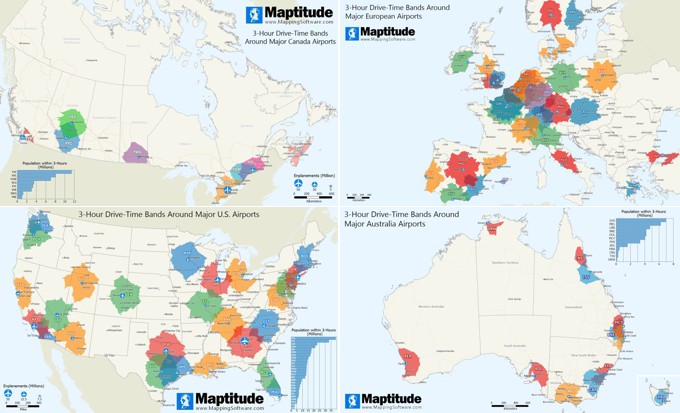
| Featured Map: Major Airport 3-Hour Drive-Time Rings New Maptitude 2025 Feature: Unlimited Drive-Time Rings! |
||||||||||
 |
||||||||||
| Tech Tips: | ||||||||||
|
||||||||||
| Maptitude Blog: Translating Big Analysis into Big Understanding 
In the latest installment of our "Business GIS for Everyone" series, Dr. Murray Rice explores how spatial segmentation transforms complex data into actionable insights. By integrating demographic and psychographic variables, businesses can uncover nuanced market segments, enabling more targeted strategies. This approach empowers organizations to move beyond traditional analysis, leveraging GIS to visualize and interpret multifaceted data effectively. |
||||||||||
|
Learning:
USA Training: July 15-17 & September 16-18 • Virtual Classroom • Details | Register
|
||||||||||


| www.MappingSoftware.com | ©2025 Caliper Corp. All Rights Reserved. |
|
Past Maptitude Newsletters |