If you need a custom map for your story, blog, or website, contact us because we offer a limited number of free custom maps on a first-come, first-served basis! See our Featured Maps for inspiration.
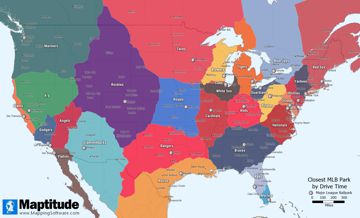
Maptitude is the best mapping software for business intelligence! Maptitude Country Packages include a point landmark database that includes thousands of points-of-interest along with a street network that you can use to create unlimited drive-time rings. The four maps below use the USA, Australia, Canada, and Europe country packages to show all of the areas accessible within a 3-hour drive of major airports in those regions.
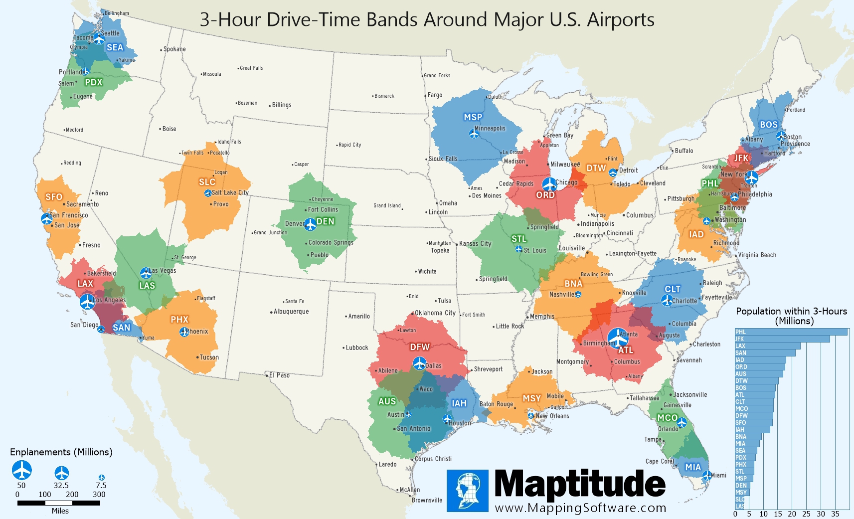
Map: Created with Maptitude Mapping Software by Caliper, June 2025
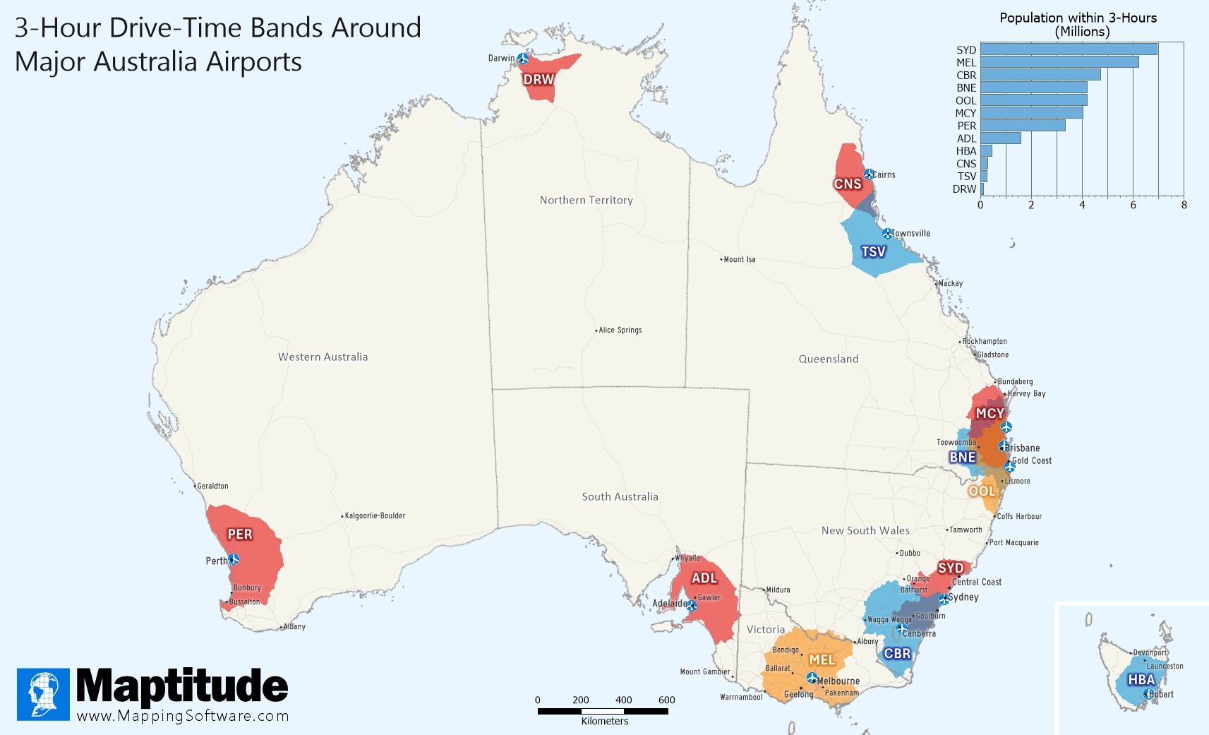
Map: Created with Maptitude Mapping Software by Caliper, June 2025
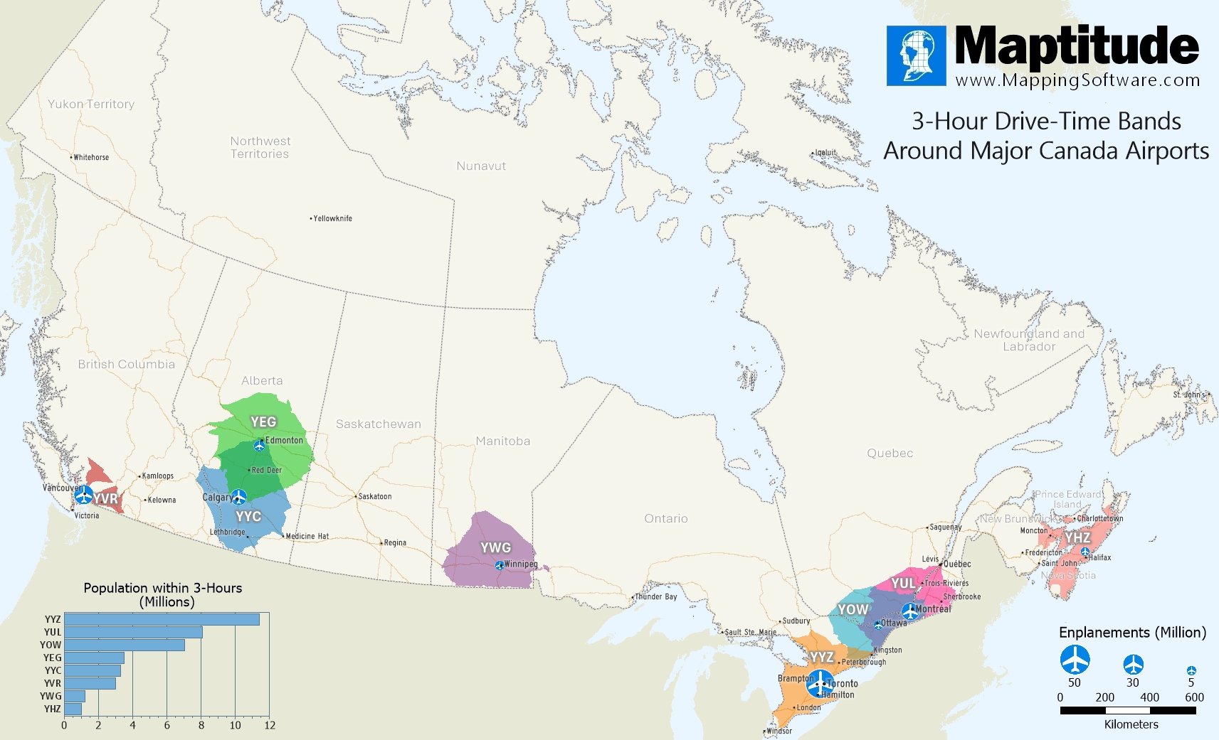
Map: Created with Maptitude Mapping Software by Caliper, June 2025
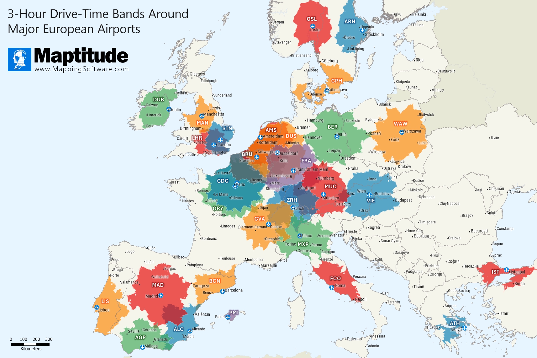
Map: Created with Maptitude Mapping Software by Caliper, June 2025
Home | Products | Contact | Secure Store
