
Author: Stewart Berry
18 June 2025
Territory management isn't just about drawing boundaries: it's about aligning your resources with opportunity. Whether you're optimizing sales coverage, service regions, or delivery zones, Maptitude 2025 delivers a powerful new suite of tools to make your territory planning smarter, faster, and more effective.
If you're still managing territories in spreadsheets or outdated systems, this release of Maptitude has the tools you need and can't find anywhere else.
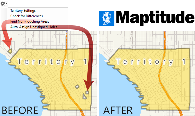
One of the best new features is now available: automatic cleanup of territory gaps and errors. Maptitude 2025 introduces tools that make it easier than ever to build complete and logical territories, no matter how messy your raw data might be.
In the real world, boundaries don't always cooperate. When small “holes” appear in your territories (areas accidentally left out), Maptitude can now automatically fill them in, assigning each one to the enclosing territory. It's fast, it's smart, and it ensures that no location gets left behind.
Use this before finalizing your map to ensure no area is missed.
Automatically fill holes within a territory
How to do it:
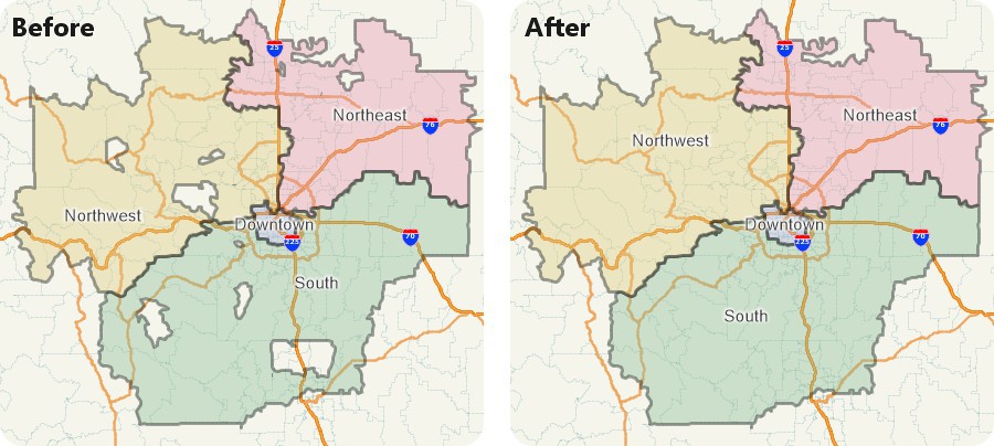
Sometimes territories split apart unexpectedly—think of a stray ZIP Code or Census Block Group added to the wrong team. Maptitude now flags disconnected territory pieces, helping you quickly find and fix breaks in geographic continuity. You no longer have to visually scan complex maps looking for outliers. The software tells you where to look and why.
Use this to ensure that your territories are compact and operationally efficient.
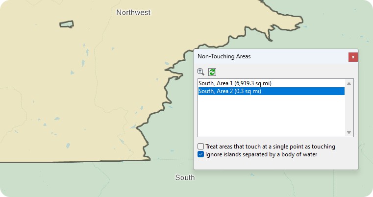
Find non-congtiguous areas automatically
How to do it:
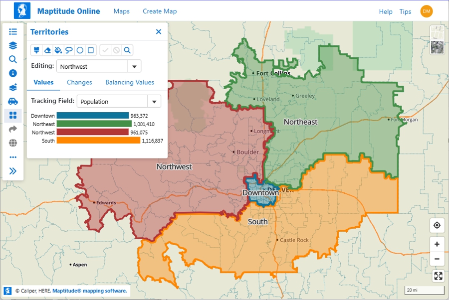
Once your territories are defined, how do you know they're fair?
The new Territory Workload Report provides a clear visual breakdown of territory balance. Whether you're measuring number of accounts, sales potential, or service workload, Maptitude shows you how each territory stacks up against the “ideal” and highlights those outside of acceptable ranges.
With built-in charts and smart tolerance thresholds, you can spot imbalance at a glance and rebalance before it costs you performance.

How to do it:
Territories don't live in isolation. They're tied to your business data, like sales representative assignments, sales numbers, or region lists.
Maptitude 2025 makes it easier to link territory maps to external tables like Excel spreadsheets or databases. If your data changes, you can refresh your map with a click - no need to start from scratch. This is especially powerful for organizations with frequently shifting teams or targets. You can even control territory boundaries based on updated data, such as automatically moving ZIP Codes between districts based on new sales volumes.
This tool is perfect for monthly or quarterly business reviews where data drives territory updates.
How to do it:
Prefer to work in the cloud? Maptitude Online now supports drag-and-drop spreadsheet uploads, enabling fast and flexible territory creation right from your browser. Assign ZIP Codes, counties, states, or Census Tracts using a simple, intuitive web interface. You can edit boundaries, assign reps, and collaborate with your team, all without desktop software.
It's perfect for distributed sales teams, franchise managers, or field service planners who need secure access anywhere, anytime.
How to do it:
With SaaS flexibility and desktop power, territory management is now wherever you are.
Whether you're planning territories from scratch or maintaining a national field force, the new territory features in Maptitude 2025 help you:
 Balance workloads intelligently
 Cover every location accurately
 Adapt quickly to organizational changes
  Collaborate in real time
  Visualize performance and act with confidence
 From auto-cleanup to dynamic reporting to cloud-based editing, Maptitude 2025 gives you all the tools you need to design smarter territories and grow smarter results.
If you already use an earlier version of Maptitude, you can upgrade to the 2025 version here. New to territory mapping? Try a free demo or reach out to our team to see how Maptitude can help.
Schedule a Free Personalized Demo
 Check out our G2 Reviews
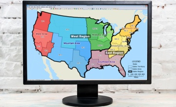


Home | Products | Contact | Secure Store
