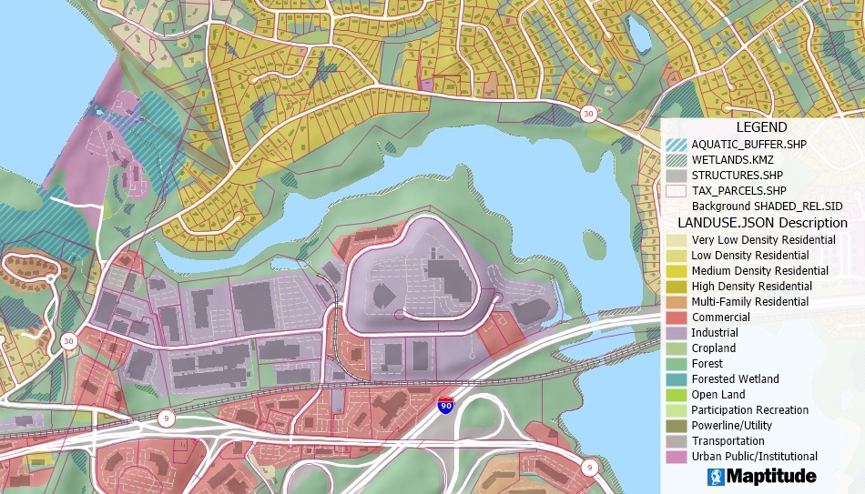
Maptitude supports over 50 file types and more than 100 GIS and CAD formats. You can map Esri Shapefiles, MapInfo TAB files, and Oracle Spatial tables directly or use the built-in translators to import geographic data from a variety of other software packages and public sources.


Home | Products | Contact | Secure Store
