| Mapping, GIS, & Transportation Software Solutions |
| Mapping, GIS, & Transportation Software Solutions |
NEWTON, MASSACHUSETTS (USA) - Caliper is excited to announce a new Canada Data Package! The product includes a wealth of data and functionality not available in any other software. Upgrade pricing is available.
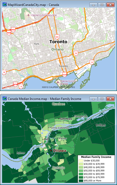
The Canada data includes a wealth of data unavailable in any other product, including an up-to-date street layer with address data for geocoding, and travel time information for computing routes and travel-time rings. Also included are building footprints for many urban locations, railroads, and comprehensive named landmarks that range from public facilities to commercial buildings including shops, restaurants, and retail stores. Demographic data from the 2006 Census describing population, age, marital status, dwelling units, families, income, language spoken, employment, and earnings data are also provided for provinces, tracts, and election districts.
Maptitude ships with one country of your choice (currently the U.S.A., Canada, or Australia), and additional packages can be purchased separately for US$695 as they become available.
You can now seamlessly switch between the countries you have purchased, which refreshes the Maptitude interface with country-specific tools such as those for finding, pin mapping (geocoding), routing, and the Create-a-Map Wizard.
Also, new Map Libraries allow you to easily create attractive geographic and demographic maps, while locating unlimited numbers of addresses and territory-based records.
If you have any questions, please call Maptitude Sales (USA) at +1 617-527-4700, or send an e-mail to sales@caliper.com.
Caliper Corporation develops state-of-the-art Geographic Information Systems (GIS) software. With a focus on usability, Maptitude is designed to be a cost-effective, professional mapping software product. Maptitude enables organizations to leverage their location-based data to improve decision making and planning, while minimizing expenditure through competitively priced solutions.
Caliper is a privately held corporation and is a leading developer of mapping, redistricting, transportation, and GIS software.

Home | Products | Contact | Secure Store