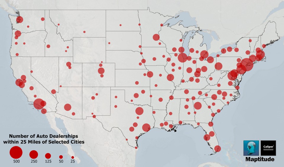
This map, made with Maptitude 2014, highlights regional variations in the number of car dealerships. Cities with more nearby businesses are shown with larger circles.
Maptitude includes the locations of several categories of vehicle dealerships including those for used cars, new cars, motorcycles, and trucks. These can be used when siting new facilities, for example, or in looking at regional coverage such as the aggregate count of dealerships by ZIP Code, County, or State.
See more map infographics Learn more about Maptitude
Map: Created with Maptitude Mapping Software by Caliper,
September 2014
Source: Maptitude 2014 Country Package HERE data
Home | Products | Contact | Secure Store
