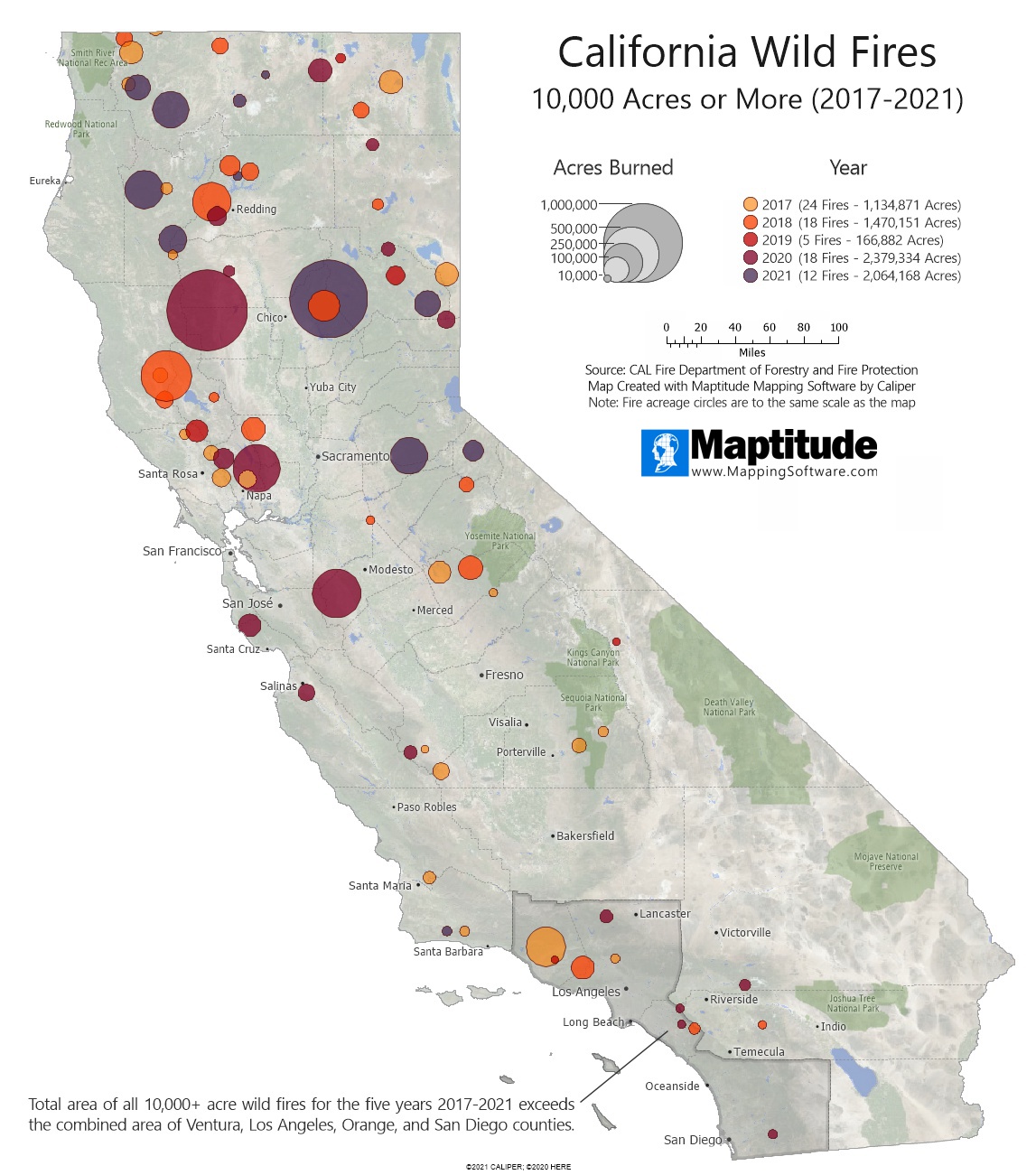
Maptitude is the best mapping software for business intelligence! This map illustrates the magnitude of the California wildfires for the five-year period from 2017-2021. The circles on the map indicate the location and size of all California fires over 10,000 acres in those five years. The circles are to the same scale as the map, so a fire of 100,000 acres is shown as a circle that encompasses 100,000 acres on the map. Combined, these large fires have burned 7.215 million acres (11,273 square miles) which is 7.1% of the total area of California and larger than the combined area of Ventura, Los Angeles, Orange, and San Diego counties (10,983 square miles).
If you need a custom map for your story, blog, or website, contact us because we offer a limited number of free custom maps on a first-come, first-served basis! See our Featured Maps for inspiration.
Map: Created with Maptitude Mapping Software by
Caliper, July 2022
Sources: CAL Fire
#Maptitude #California #wildfires
Home | Products | Contact | Secure Store
