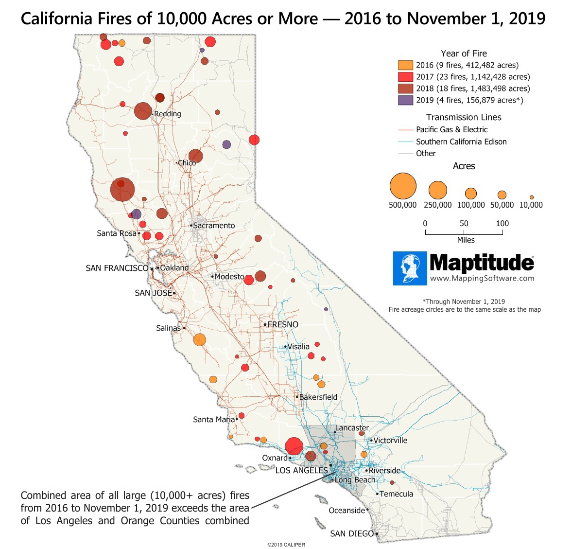
Maptitude is the best mapping software for business intelligence! This month's featured map illustrates the magnitude of the recent California wildfires. The circles on the map indicate the location and size of all California fires over 10,000 acres, from 2016 through Novermber 1, 2019. The circles are to the same scale as the map, so a fire of 100,000 acres is shown as a circle that encompasses 100,000 acres on the map.
So far there have been 54 fires of this magnitude since 2016. The largest of these fires was the Mendocino Complex fire in 2018 that burned 459,000 acres. The largest so far this year, the Kincade fire just north of Santa Rosa, is still active as of November 1, and has already burned over 77,500 acres. Combined, these large fires have burned 3,195,287 acres (4,992 square miles) which is larger than Los Angleles and Orange counties combined (4,886 square miles).
Because electrical transmission lines have been faulted for several of these fires, they have also been included in the map. The color of a transmission line indicates its ownership.
Map: Created with Maptitude Mapping Software by
Caliper, November 2019
Sources: CAL Fire, California Natural
Resources Agency
#Maptitude #California #wildfires
Home | Products | Contact | Secure Store
