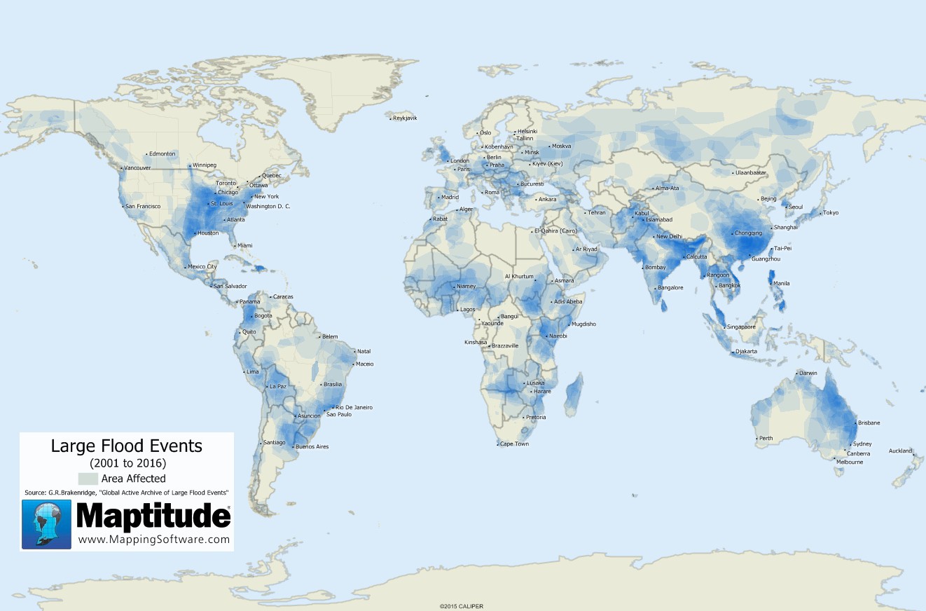
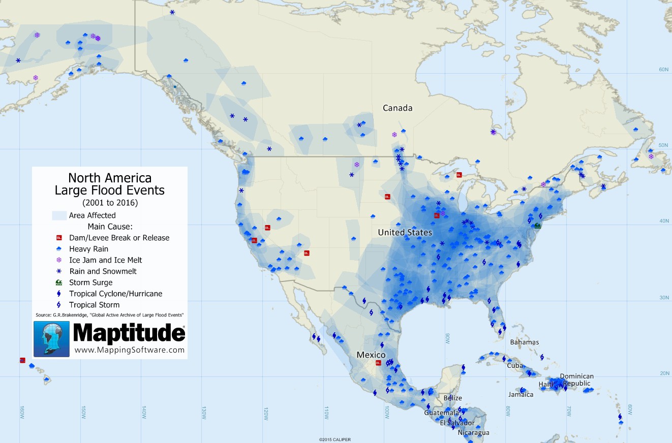
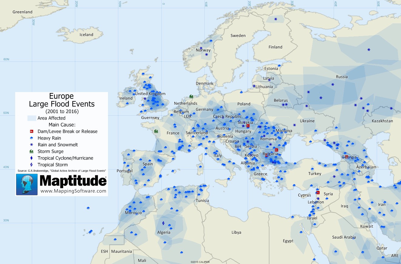
This world map shows the areas affected by large flood events occurring between 2001 and June 2016. Areas with multiple overlapping events are in darker blue. The data are from G.R.Brakenridge, "Global Active Archive of Large Flood Events", Dartmouth Flood Observatory, University of Colorado, http://floodobservatory.colorado.edu/Archives/index.html. Scroll down to see more detailed maps that include flooding causes for North America and Europe.
See more map infographics Learn more about Maptitude
Map: Created with Maptitude Mapping Software by Caliper, June 2016
Home | Products | Contact | Secure Store
