| Mapping, GIS, & Transportation Software Solutions |
| Mapping, GIS, & Transportation Software Solutions |
Caliper Transportation Blog
Based upon earlier research performed for FHWA, Caliper has developed a new version of the Transportation Planner's Accessibility Toolkit or TPAT. TPAT is an add-on to TransCAD and uses the highly efficient network computational engine in TransCAD to produce informative accessibility measures and graphics.
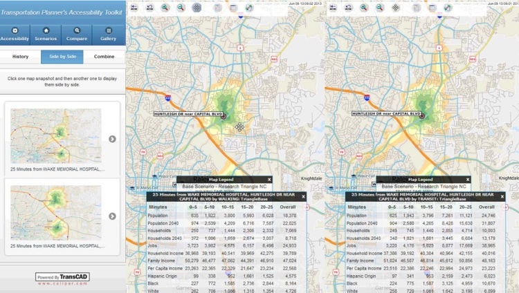
Side-by-side comparison using the Caliper transportation planner's accessibility toolkit
The toolkit produces accessibility measures for driving, transit, cycling, and walking. Accessibility can be rapidly calculated and mapped from a location, to a location, or between all locations of residences, census blocks, employment locations, employment zones, service locations, stores, and facilities such as hospitals.
Travel networks are provided that are up-to-date and reflect current road networks and transit services. The travel networks can be edited to reflect improvements from future transportation projects. Comparisons of before and after accessibilities associated with improvement projects can be easily produced and quantified along with associated geographic analysis.
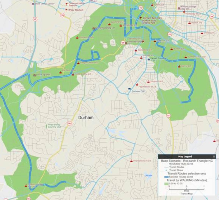
Ten-minute transportation accessibility band around a bus route
While earlier implementations used a variety of different network data sources, the new TPAT uses highly accurate street files and point-of-interest locations from HERE as well as Census and other sources of demographic data. Caliper prepares the latest data annually to reflect current road conditions and public transit services. Caliper also assists in integrating local data and customizing the accessibility calculations for each application.
PDF Transportation Planner’s Web-based Accessibility Toolkit Final Report - Prepared by Caliper for Office of Planning & Environment, FHWA
Home | Products | Contact | Secure Store