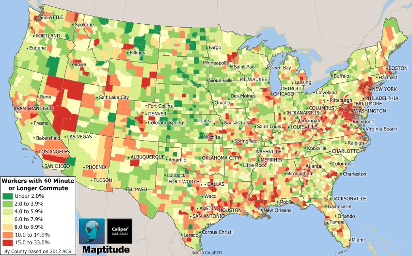
Maptitude is the best mapping software for business intelligence! This map illustrates the portion of the working population in each U.S. county with commute times in excess of 60 minutes. Maptitude 2014 allows you to map these differences in travel time to work, average travel time, number of vehicles per household, and mode of transportation.
If you need a custom map for your story, blog, or website, contact us because we offer a limited number of free custom maps on a first-come, first-served basis! See our Featured Maps for inspiration.
Map: Created with Maptitude Mapping Software by Caliper,
March 2014
Source: 2012 American Community Survey
Home | Products | Contact | Secure Store
