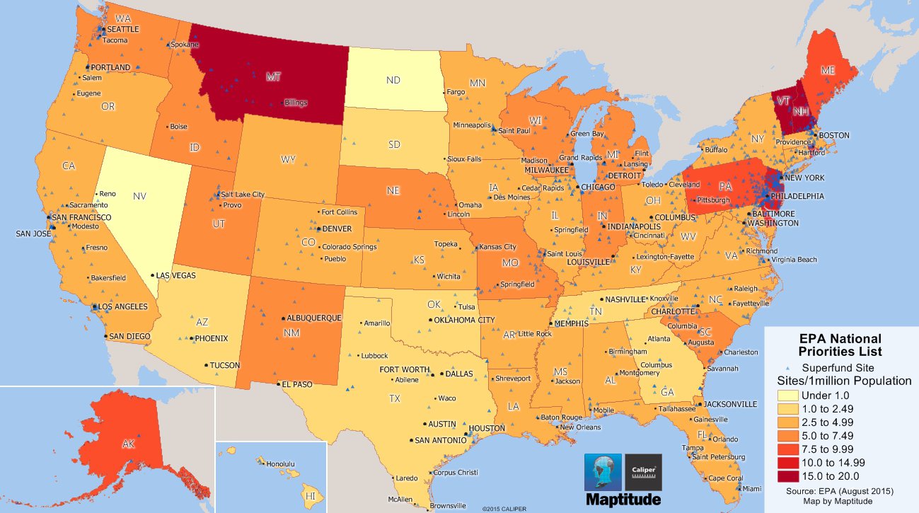
Maptitude is the best mapping software for business intelligence! This Maptitude map shows the locations and concentrations of EPA National Priorities List, also known as Superfund, sites. These sites require a long-term response to clean up hazardous contaminants. Each triangle shows the location of a NPL site, and the states are shown with a color theme showing the per capita concentration of sites
If you need a custom map for your story, blog, or website, contact us because we offer a limited number of free custom maps on a first-come, first-served basis! See our Featured Maps for inspiration.
Map: Created with Maptitude Mapping Software by Caliper,
September
2015
Source: EPA August 2015
Home | Products | Contact | Secure Store
