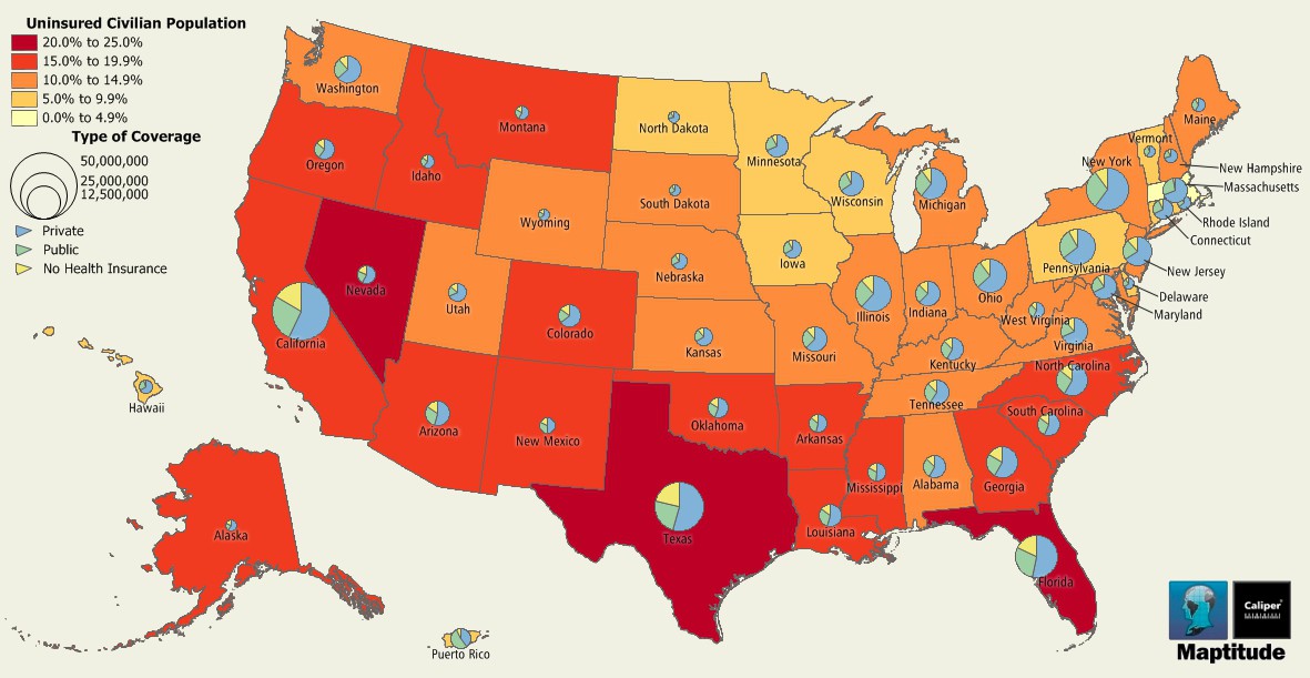
Maptitude is the best mapping software for business intelligence! This map illustrates the portion of the civilian population that is without health insurance and the type of coverage (private, public, none) for the entire civilian population. The data here are at the state level and are included with the latest United States Country Package available for Maptitude. The new Country Package also includes the data at the county and tract level too.
Map: Created with Maptitude Mapping Software by Caliper, February 2014
Home | Products | Contact | Secure Store
