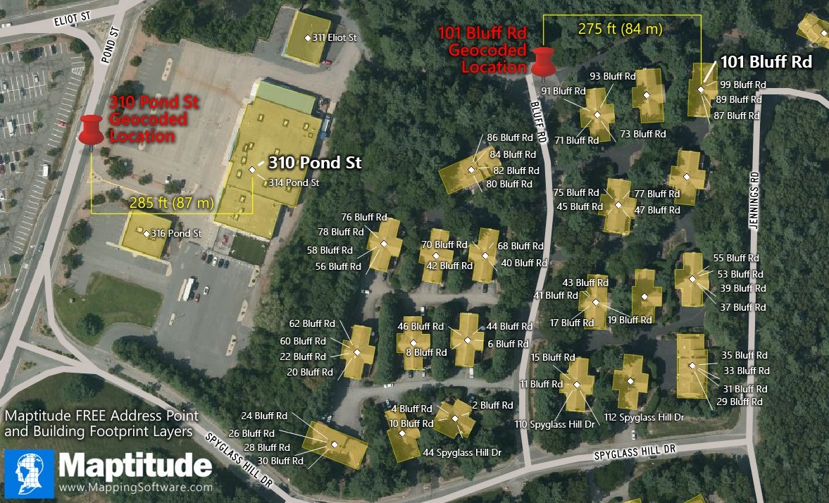
Maptitude is the best mapping software for business intelligence! This map shows the free building footprint and address point rooftop data available to users of the current version of Maptitude.
The building footprints are available for the United States (over 124 million buildings), Canada (over 12 million buildings), or Australia (over 11 million buildings). These layers contain many more building footprints than are in the building footprint layer included with Maptitude and provide additional detail to your maps.
The Address Point Rooftop points are for addresses in 22 states and the District of Columbia. Because this layer locates address at the rooftop center, it offers even greater precision than simply geocoding. For example, the red pins in this map show the typical geocoded locations of two addresses and their respective rooftop locations, which in both cases are almost a football field farther away. This layer is perfect for direct mail campaigns, door-to-door canvassing, school districting, and any other application for which more precise address data are required.
Map: Created with Maptitude Mapping Software by Caliper, December 2020
#Maptitude #building #footprint #rooftop #address
Home | Products | Contact | Secure Store
