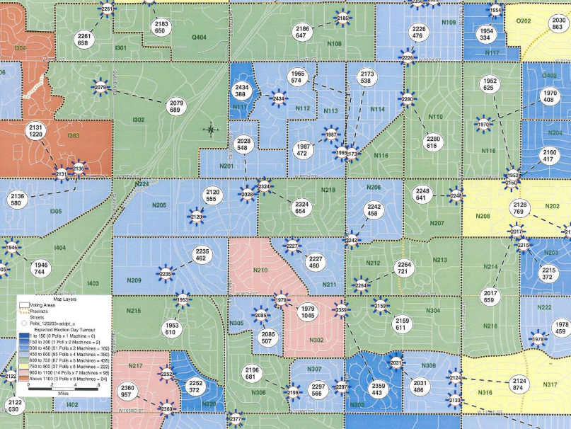
Maptitude is the best mapping software for business intelligence! Polling place locations are evaluated for compliance with ADA and general voter convenience and are spatially located. Then precincts are grouped together forming consolidated voting areas that are displayed on the map. Voting areas are color coded to show the projected number expected to vote. The map is monitored daily to track the expected vote and is used to assign sufficient ballots and voting booths to polling places and provide an opportunity to assign experienced election workers to polling places with large numbers of expected voters. This and similar maps can be found here.
Featured Maptitude Mapping Software Map: May 2013
Created by: Connie Schmidt, Election
Commissioner,
Johnson County, May 2004
Home | Products | Contact | Secure Store
