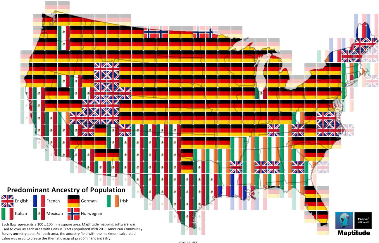
Maptitude is the best mapping software for business intelligence! This map shows the predominant country of ancestry for regions in the United States. Each flag represents a 100 x 100 mile square area. Maptitude was used to overlay each area with Census Tracts populated with 2011 American Community Survey ancestry data. The flag of the country with the maximum calculated value was used to create the thematic map of predominant ancestry.
Map: Created with Maptitude Mapping Software by Caliper, September 2013
Home | Products | Contact | Secure Store
