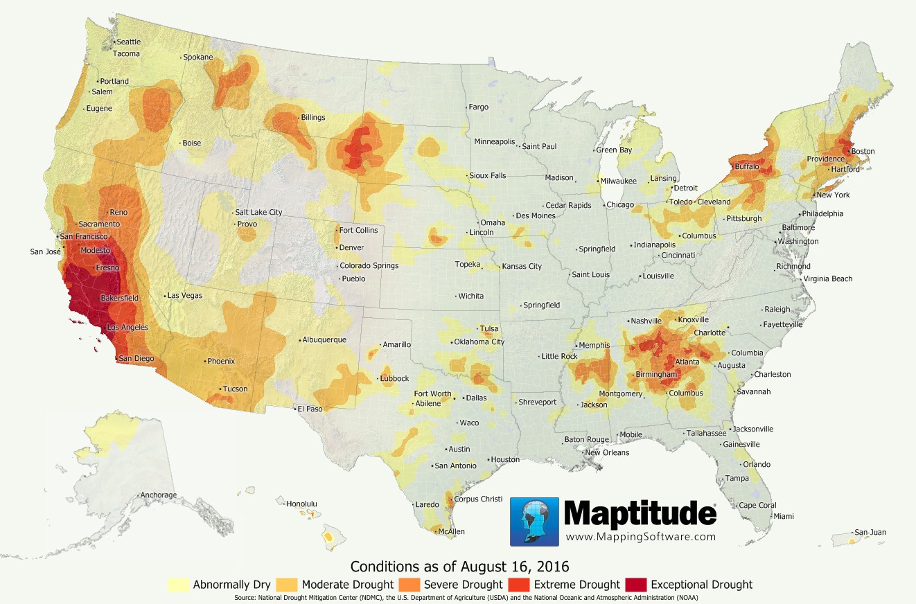
Despite the recent heavy flooding in Louisiana, much of the United States remains quite dry with abnormally dry conditions now covering 40% of the land area in the United States as of this month. While Arizona, California, and Nevada have experienced extreme drought conditions for all of 2016, this Summer has brought similar conditions to other populous areas including around Atlanta, Boston, and Buffalo.
Map: Created with Maptitude Mapping Software by
Caliper, August
2016
Source: National Drought Mitigation Center, the U.S.
Department of Agriculture, and the National Oceanic and Atmospheric
Administration
Home | Products | Contact | Secure Store
