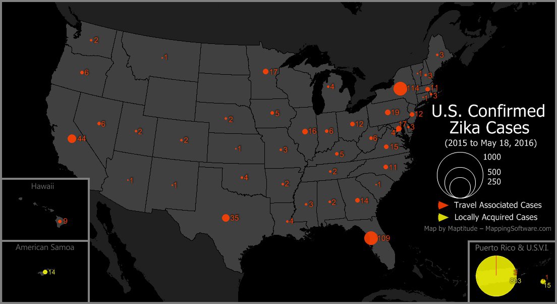
Maptitude is the best mapping software for business intelligence! This map, made with Maptitude, shows the states and territories that, according to the Center for Disease Control, have had confirmed cases of Zika virus. Locally acquired, mosquito-borne cases have been reported in Puerto Rico, the Virgin Islands, and American Samoa. Non-vector, travel associated cases have been reported in 44 states, Washington DC, Puerto Rico, and the Virgin Islands.
Map: Created with Maptitude Mapping Software by Caliper,
May
2016
Source: CDC
Home | Products | Contact | Secure Store
