Mapping Software and GIS Glossary
An overlay is a procedure that estimates the attributes of one or more features by superimposing them over other features, and figuring out the extent to which they overlap. You use overlays to estimate the attributes of features in a map layer based on data in another map layer.
For example, you can use an overlay to calculate:
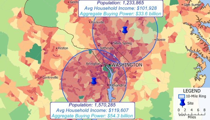
Estimate the populations and other demographic characteristics of areas such as the circular rings in this map by overlaying then with the Census tract layer
Maptitude Mapping Software gives you all of the tools, maps, and data you need to analyze and understand how geography affects you and your business. Estimate attributes around point, line, or area features.
Learn More Free Trial Free for Students/Teachers
![]()
![]()
![]()
![]()
![]()
![]()
![]()
![]()
Home | Products | Contact | Secure Store
