Mapping Software and GIS Glossary
In geography, latitude is the distance on the earth’s surface, north or south of the Equator, expressed in angular measurements from 0° at the Equator to 90° (North or South). Southern latitudes can also be expressed as negative number where -90° is at the South Pole. Lines of latitude run parallel to the Equator. Latitude and longitude can be used together to specify a precise location on the Earth.
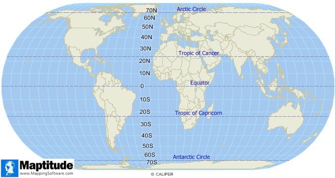
Latitude is expressed in degrees North or South of the Equator. Other important latitude lines include the tropic circles, the Arctic Circle, and the Antarctic Circle.
Maptitude Mapping Software gives you all of the tools, maps, and data you need to analyze and understand how geography affects you and your business. Maptitude includes tools for locating your data using latitude and logitude coordinates, address, postal code, and more.
Learn More Free Trial Free for Students/Teachers
![]()
![]()
![]()
![]()
![]()
![]()
![]()
![]()
Home | Products | Contact | Secure Store
