Maptitude for Precincts and Election Management is Geo-Enabled Elections software that is ideally positioned to support the efforts of the National States Geographic Information Council (NSGIC) in spearheading an effort to increase election accuracy and efficiency. Specifically, via NSGIS’s Geo-Enabled Elections project which provides assistance in implementing GIS technology to ensure accurate voter data as well as developing best practices in data maintenance. Maptitude can play a role in this effort to support a centralized approach to data maintenance.
Maptitude is already used to assist county-level jurisdictions with the ongoing maintenance of elections data.
 |
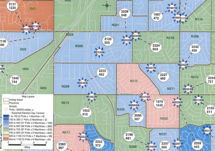
“It is true — it takes a community to conduct a successful election. Using GIS to manage an election has provided the Johnson County Election Office necessary internal control over what can best be described as a "moving target" — conducting an election. The power of visualization extends the efficiency of the process while helping maximize convenience to the voter.”
|

|
“I use the Caliper product Maptitude because it is easier. It's more user friendly. It uses some of the terminology that I use in a day-to-day basis.”
|
 Johnson County, KS Using GIS to Manage an Election |
 Ornage County, CA Enhancing the Election Process |
 Marion County, FL Geo-enabling elections |
|
Marion County, FL Reprecincting with GIS |