Mapping Software and GIS Glossary
A census block is the smallest entity for which the Census Bureau collects and tabulates census information. There are about 11 million census blocks in the United States. In urban areas, a census block is typically equivalent to a city block bounded by streets on all sides. In rural areas, however, a census block may be larger and bounded by streets, streams, railroad tracks, city limits, or county boundaries.
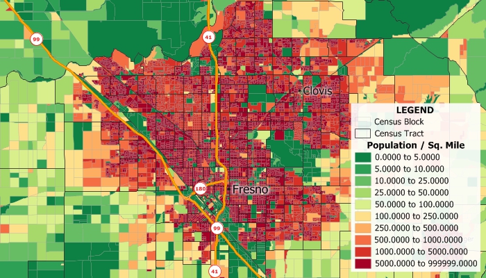
What is census block? This Maptitude map shows the population density by census block around Fresno, California. Blocks shown in dark red have many people living on that block and blocks shown in green have few people living there.
Maptitude Mapping Software gives you all of the tools, maps, and data you need to analyze and understand how geography affects you and your business. Census block population data are available for Maptitude.
Learn More Free Trial Free for Students/Teachers
![]()
![]()
![]()
![]()
![]()
![]()
![]()
![]()
Home | Products | Contact | Secure Store
