Mapping Software and GIS Glossary
A catchment area is the geographic area for which a facility attracts clients or customers. The size and shape of a catchment area will depend on how accessible a facility is and how far it is from alternative facilities.
Thiessen polygons, shapes defining an area of influence around a point, assign any given location within the area of interest to its nearest facility. For example, Thiessen polygons can be used to illustrate catchment areas for facilities such as subway stations, and thus illustrate the areas most accessible to each station.
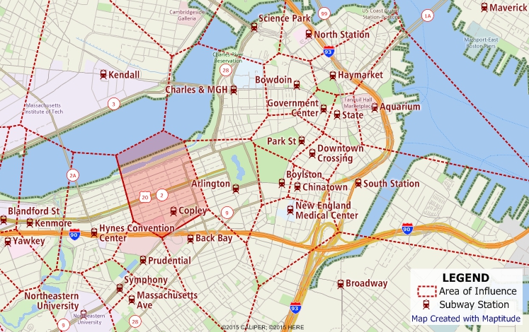
Thiessen polygons in this map show the catchment areas for each subway station. Anywhere in the shaded polygon is closest to the Copley subway station.
A catchment area can also be defined by an arbitrary distance or time. For example, if one know that clients are unwilling to travel more than 10 miles to get to a facility, one can use buffers to create circular catchment areas that are no more than 10 miles from a facility. Similarly, if clients are unwilling to drive more than 30 minutes to a facility, one can use network partitioning to show the areas that are within a 30-minute drive-time from a facility.
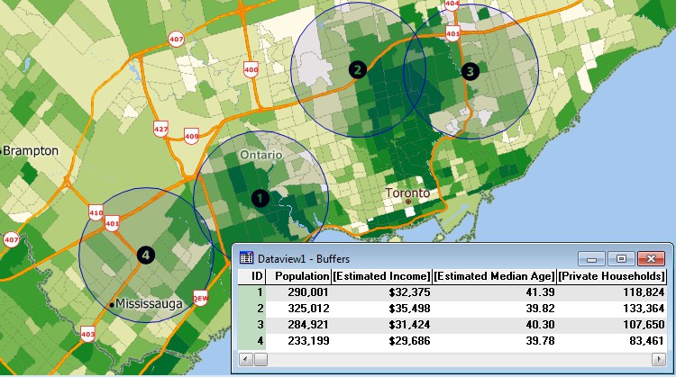
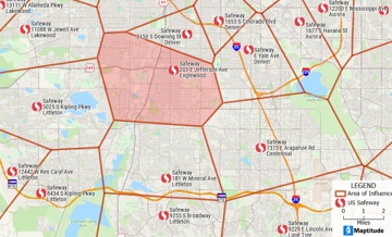
Buffers in this map show the catchment areas for several stores. Population and other statistics have been calculated so that you can compare the different catchment areas.
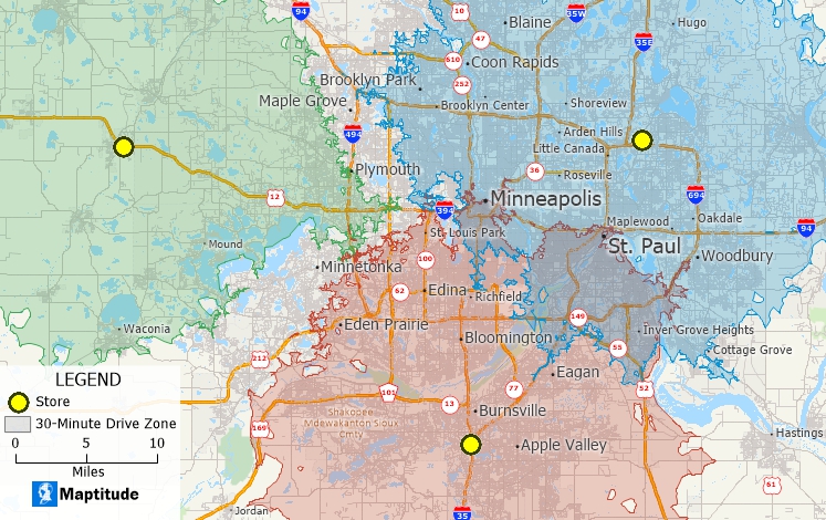
30-minute drive-time bands in this map show the catchment areas for several stores.
Maptitude Mapping Software gives you all of the tools, maps, and data you need to analyze and understand how geography affects you and your business. Define catchment areas using thiessen polygons, buffers, or network partitions.
Learn More Free Trial Free for Students/Teachers
![]()
![]()
![]()
![]()
![]()
![]()
![]()
![]()
Home | Products | Contact | Secure Store
