Mapping Software and GIS Glossary
A distance table shows the driving distance over streets from one or more origins to one or more destinations. A distance table is useful for finding out how far customers are willing to drive to a store and nearest store alternatives. A distance table is also useful to determine which students in a city are eligible to use a school bus. A distance table is typically a matrix where the origins are shown in the first column and the destinations are shown in the first row. The distance from any origin to a destination is shown where the row and column intersect.
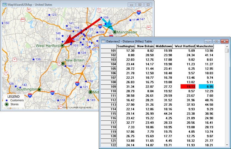
This distance table shows how far different stores are from customers. For example, customer 109 is 8.95 miles from the Manchester store and 19.13 miles from the West Hartford store.
Maptitude Mapping Software gives you all of the tools, maps, and data you need to analyze and understand how geography affects you and your business. Maptitude includes tools for creating distance tables and drive-time tables.
Learn More Free Trial Free for Students/Teachers
![]()
![]()
![]()
![]()
![]()
![]()
![]()
![]()
Home | Products | Contact | Secure Store
