Mapping Software and GIS Glossary
A location map allows you to visualize where a place or thing is located on the earth. A location map can be anything such as a single address, a building, landmark, or store, a neighborhood, city, or state, a sales territory, a country, or anything else that can be displayed visually on a map.
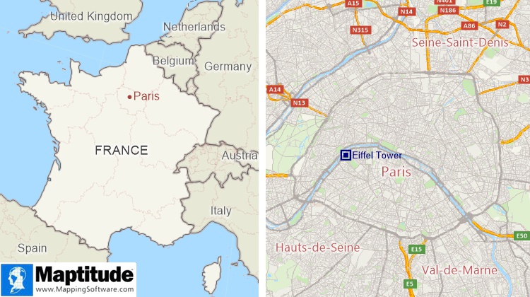
A location map showing where Paris is located in France and a location map showing where the Eiffel Tower is located in Paris
Maptitude Mapping Software gives you all of the tools, maps, and data you need to analyze and understand how geography affects you and your business. Create informative location maps using the detailed data that are included.
Learn More Free Trial Free for Students/Teachers
![]()
![]()
![]()
![]()
![]()
![]()
![]()
![]()
Home | Products | Contact | Secure Store
