Mapping Software and GIS Glossary
A map scale is the relationship between a distance on a map and the corresponding distance on the earth. Map scale may be expressed as an equivalence, usually by different units (e.g., 1inch = 1mile or 1:63,360); or graphically, as a bar scale. Large scale maps make each feature look larger, and show a smaller geographic area. Small scale maps make each feature look smaller, and show a larger geographic area.
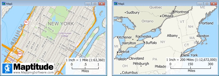
What is map scale? The map on the left is a larger scale map of New York City where one inch equals one mile and every map feature is drawn 1/63,360 the actual size on the earth. The map on the right is a smaller scale map of New York where one inch equals 200 miles and every map feature is 1/12,672,000 the actual size on the earth.
Large-Scale Maps vs Small-Scale Maps
Large-scale maps and small-scale maps serve different purposes and are both necessary for various applications. Maps with larger scales provide precision, while smaller scales offer a broader spatial perspective. Therefore, the scale of a map should complement its purpose and be tailored to the type of spatial analysis it is presenting.
A larger scale map with street-level or parcel-level detail is necessary for city planning, property surveys, or showing turn-by-turn navigation within a city. A smaller scale map of a state with highway-level detail is necessary for regional planning and intercity navigation. An even smaller scale map of a country would be useful for understanding broad geographic relationships and long-distance navigation.
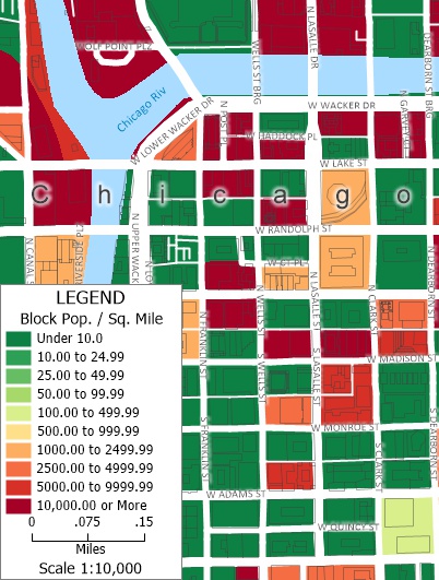
A larger scale 1:10,000 map of population density by block. Map features are 1/10,000 their actual size.
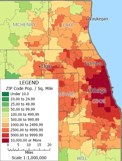
A 1:1,000,000 scale map of population density by ZIP Code. Map features are 1/1,000,000 their actual size.
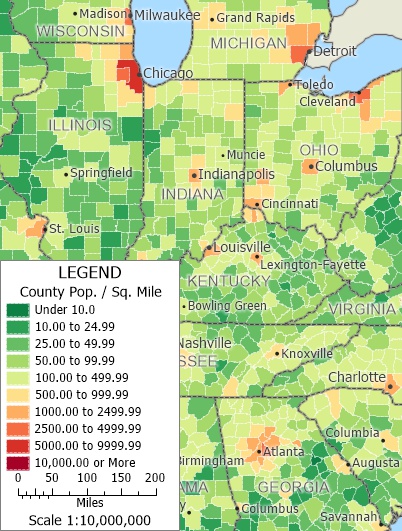
A smaller scale 1:10,000,000 map of population density by County. Map features are 1/10,000,000 their actual size.
Showing Map Scale on a Map
There are three common ways to depict a map's scale:
Maptitude Mapping Software gives you all of the tools, maps, and data you need to analyze and understand how geography affects you and your business. Maptitude can be used to make maps at any scale.
Learn More Free Trial Free for Students/Teachers
![]()
![]()
![]()
![]()
![]()
![]()
![]()
![]()
Home | Products | Contact | Secure Store
