Mapping Software and GIS Glossary
Address mapping (also know as pin mapping or geocoding) is the process of assigning map coordinate locations to addresses in a database. A GIS is capable of doing this by comparing the elements of each address in the database (e.g., the number, prefix direction, street name, suffix direction, and type) to the attributes of each line segment in a street centerline layer to find a match. The starting and ending address of the matched line segment is used to locate the precise coordinate position. The output of address mapping is a point layer attributed with all of the data from the input database.
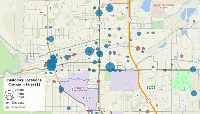
This map shows the results of address mapping a data table of customer data. All of the original source data, such as sales volume, are also available for mapping and labeling the address mapped point features.
Maptitude Mapping Software gives you all of the tools you need for address mapping and analyzing your data. Find out exactly where your customers are, find over- and under-served areas, plan routes, create territories, and more.
Learn More Free Trial Free for Students/Teachers
![]()
![]()
![]()
![]()
![]()
![]()
![]()
![]()
Home | Products | Contact | Secure Store
