Mapping Software and GIS Glossary
An equidistant projection is a map projection that accurately preserves distances from one or two specific points or along particular lines, depending on the type of projection used. However, not all distances on the map are preserved – only those defined by the projection's constraints. For example:
While equidistant projections do not preserve shape or area, they are useful for applications that require accurate distances from a specific location, such as in radio communication, seismic mapping, or airline route planning.
On a globe, the shortest distance between two points is along a great-circle path. On an equidistant map centered at one of those points, this great-circle distance is represented correctly as a straight line from the center to the other point. However, distances between two non-central points may not be accurate unless the projection specifically maintains those.
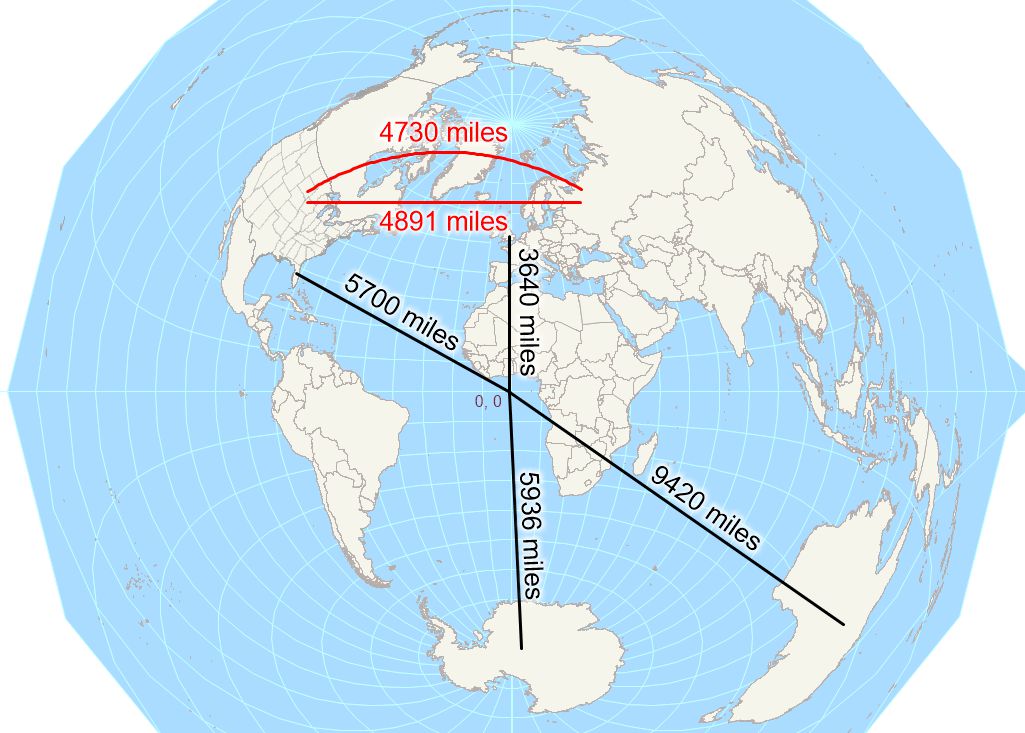
In the map, different types of distance are shown to demonstrate a key property of the projection: it preserves distance and direction from the center, but not between other locations.
Maptitude Mapping Software gives you all of the tools, maps, and data you need to analyze and understand how geography affects you and your business. Maptitude supports dozens of projections to suit your needs.
Learn More Free Trial Free for Students/Teachers
![]()
![]()
![]()
![]()
![]()
![]()
![]()
![]()

Home | Products | Contact | Secure Store
