Mapping Software and GIS Glossary
Cartography is the art, science, and technology of expressing graphically, by maps, charts, three-dimensional models and globes, the known physical features of the earth or any heavenly body, at any scale. In particular, cartography is concerned with all phases of map finishing, including the designing of format and symbolization; drafting, editing, and proofing of map content; and specifying requirements for reproduction.
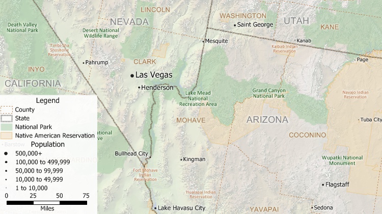
Cartography showing the features, political boundaries, and cities of the American Southwest produced with Maptitude mapping software
Maptitude Mapping Software gives you all of the tools you need to create maps at any scale, with full cartographic control of map symbols, colors, sizes, and contents. Further, Maptitude includes analysis tools that allow you to cartographically show data with a geographic component through the use of choropleth maps, dot-density maps, thematic maps, and more.
Learn More Free Trial Free for Students/Teachers
![]()
![]()
![]()
![]()
![]()
![]()
![]()
![]()
Home | Products | Contact | Secure Store
