Mapping Software and GIS Glossary
Geotagging refers to the attaching of geographic coordinate information to images, video, and other media recorded by smartphones or GPS-enabled electronic devices. Geotagged photographs, for example, contain geospatial metadata such as latitude and longitude coordinates, altitude, bearing, and more.
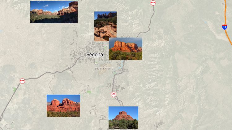
Maptitude Mapping Software gives you all of the tools you need to locate and analyze your data. In addition, Maptitude can read geotags from images and create points in a geographic file based on the coordinate information in the images. Fields in the geographic file are populated with the image file name and other location information read from the geotags.
Learn More Free Trial Free for Students/Teachers
![]()
![]()
![]()
![]()
![]()
![]()
![]()
![]()
Home | Products | Contact | Secure Store
