Mapping Software and GIS Glossary
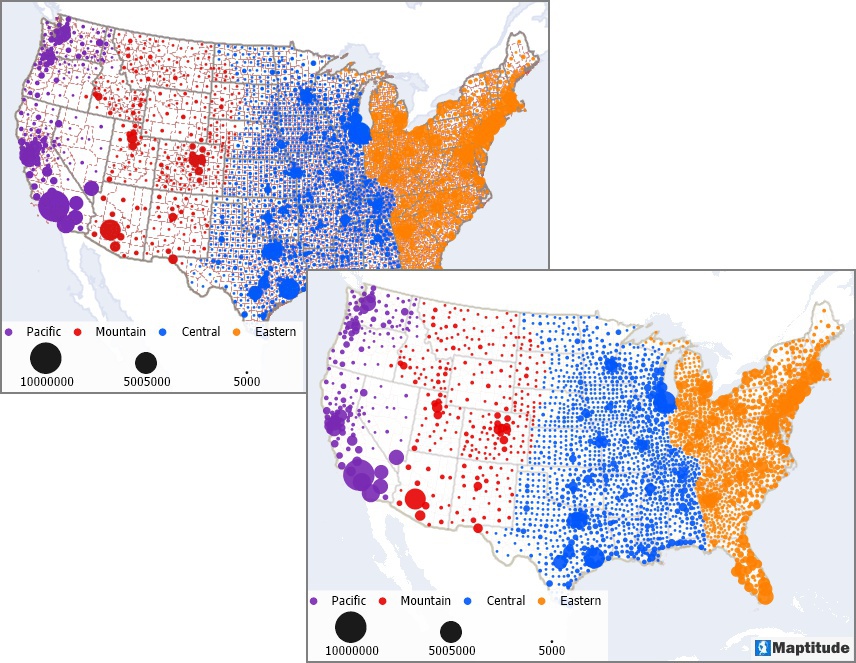
Map transparency is a method used to highlight trends in your thematic data and make patterns more comprehensible by varying the level of opacity in map features.
There are several reasons you may want to apply some transparency to a map:

By applying some transparency to the colored dots in this map, it is possible to see the smaller dots that would otherwise be completely hidden by larger ones such as the large purple dot in Los Angeles, California. Also, by applying transparency to the county boundaries it makes the thematic map easier to see and understand.
Maptitude Mapping Software gives you all of the tools, maps, and data you need to analyze and understand how geography affects you and your business. Maptitude lets you customize the display of all features in a map including setting levels of opacity.
Home | Products | Contact | Secure Store