Mapping Software and GIS Glossary
Travel Contiguity is the ability to travel across a district without leaving a district. Districts with higher travel contiguity percentages are preferred because more intersections can be reached by walking, driving, or a combination of modes, without leaving the district.
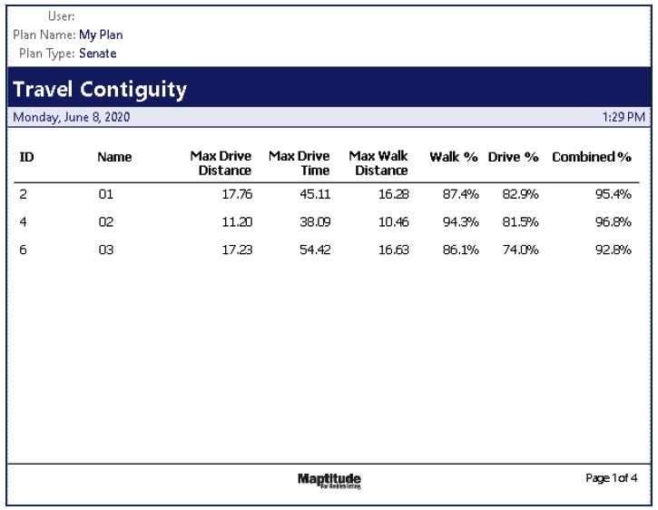
Maptitude for Redistricting is the only solution that incorporates travel contiguity analysis, a powerful tool that helps ensure districts are not just geographically connected, but functionally connected through real-world transportation networks.
Districts with high travel contiguity are easier to navigate using public transit, which is especially important for residents without access to personal vehicles. This kind of connectivity fosters a stronger sense of community, shared interests, and equitable access to services.
By aligning district boundaries with actual travel patterns and transit infrastructure, Maptitude helps decision-makers:
This approach goes beyond traditional mapping by demonstrating a deeper understanding of the communities being served.
Home | Products | Contact | Secure Store
