Since 1995 the Maptitude mapping software has made it easy to access a wealth of Canada Census data. You can quickly visualise Census demographics using a suite of wizard-driven tools. Maptitude also provides a map library that contains numerous pre-designed maps listed by Census category. These include thematic maps of demographic, income, and housing data.
For Canada, Maptitude contains over 1600 fields of Census and National Household Survey data describing population, age, dwelling units, marital status, family size, family composition, language spoken, educational attainment, employment, mode of commute, ancestry, earnings, and income data. The data are provided for Census Divisions, Subdivisions, Metropolitan Areas, and Tracts, as well as for Provinces and Federal Election Districts. Learn more about the included data on the Canada Country Package page.
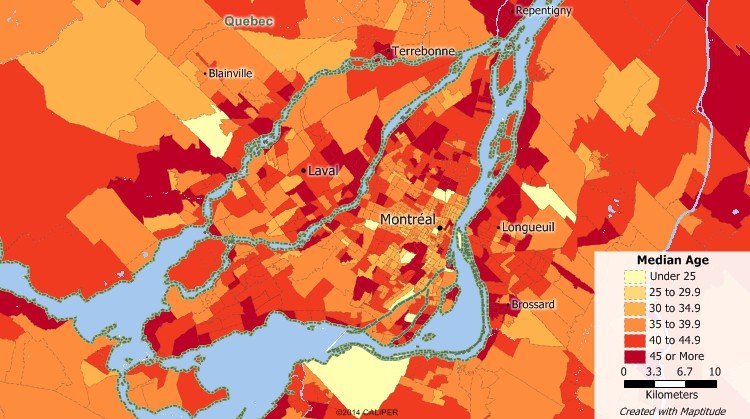
Maptitude census data map of median age around Montreal using Canada census data included with Maptitude.
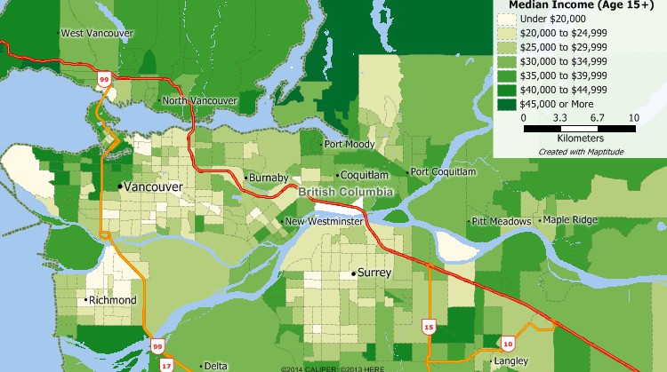
Maptitude census data map of income around Vancouver using Canada census data included with Maptitude.
Use the provided Census data with the analysis tools in Maptitude to make more informed and strategic business decisions and identify growth opportunities. With Maptitude, you will be able to define markets, compare sites, locate and better understand your customers, create territories, and target your audience. Maptitude costs just US$795 and includes a FREE Country Package so you can start your Canada Census data mapping as soon as you install the software.
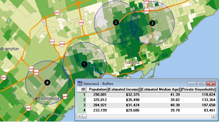
Use the Maptitude tools to evaluate locations using the Canada Census data.
 |
“I have used Maptitude to expose undergraduate and graduate students to the power of GIS. The built in data and map layers allow the students easily perform advanced spatial analysis and data visualization with a minimal amount of training.”
|
Home | Products | Contact | Secure Store
