The Create-a-Map Wizard™ tool in
Maptitude gives you start-to-finish assistance for
creating pin maps (geocoding), geographically analyzing, and mapping your
data. In a few easy steps, you can locate your customers, color
code ZIP/Postal Codes with your sales data, build bands around
your stores, and much more.
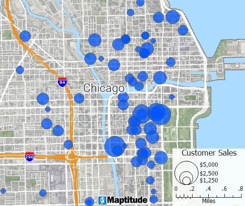
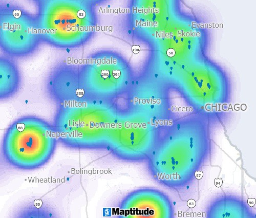
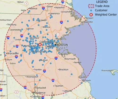
You can use the built-in geocoding
tools to pin map your data. By locating a point feature for
every record in your table you can see the distribution of your
customers, facilities, or other resources.
Pin Map Features
-
Locate features by address, intersection, ZIP/Postal Code, town, coordinate, or by clicking on the map
-
Standardize addresses automatically
-
Choose the offset distance from the street
-
Choose whether to scatter locations when geocoding by postal code or city
-
Locate addresses without postal codes
-
Geocode automatically or use prompted geocoding
-
Choose the level of strictness for matching
-
Geocode using flexible matching that handles data errors in addresses and postal codes
See a
video showing how to locate your data using Maptitude mapping
software
Application Development
Whether you use the in-process extension API or the
out-of-process connection API, you can access more than 850 GIS
functions. These functions include:
- Geocoding street addresses using your licensed country
data packages
- Geocoding tables of street addresses
- Reverse geocoding: obtaining information about all the
map layers for an input geographic coordinate
Learn more
about application development and see programming examples of
geocoding addresses and tables
Maptitude is competitively priced and enables organizations and
businesses to use their location-based data to improve decision making.
Why spend more for less?

Free Trial Request a Demo
“ The single most important feature is
unlimited geocoding on high quality and accurate street data.
Address geocoding is fundamental to decisions based on
geographic data. Maptitude provides tools to assess and review
match success rates based on updatable and reliable street data,
while providing alternative levels of accuracy and modifiable
geocoding rules.”
GISCafe
Maptitude Demo:
 Check out our G2 Reviews