You can use the very affordable but powerful Maptitude mapping software to geocode or create drive time rings or map or create territories (among many other types of analysis!), and then easily visualize and further analyze the data in Microsoft Power BI.

|
“It is the most user-friendly mapping software I've used so far (compared to Power BI, Tableau, Excel 3D Maps). Any time I've need help, the user support was very responsive and helpful. I haven't found anything I dislike yet. It is easy to use and navigate around. It is solving how we locate our potential targets. By placing different layers across the map, we can see distance and boundaries from our targets to our facilities.”
|

|
“You cannot compare mapping in Power BI, with true GIS software such as Maptitude. I have been using Maptitude for many years now as my favourite GIS and prepare maps for Power BI with it. Thus benefitting from both worlds, where Power BI adds a dynamic element to the analysis and visualisation layers, created in Maptitude.” Paul Lucassen |
Free Trial Request Demo Learn More
There are many benefits when you use Maptitude to create maps for Microsoft Power BI™:
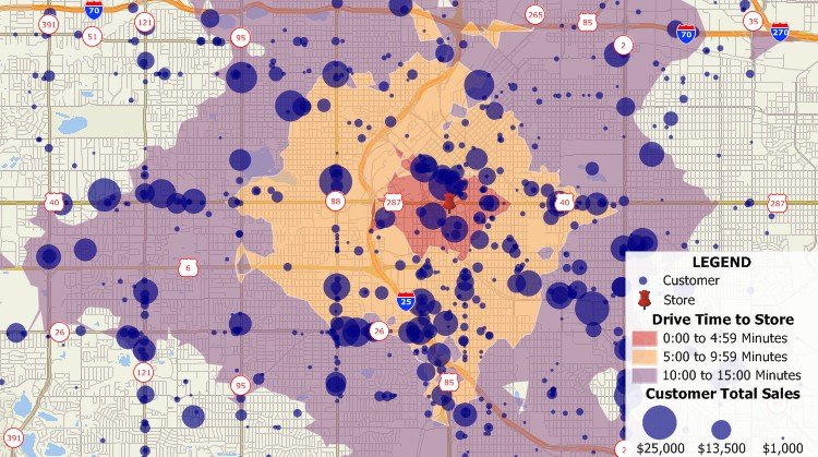
Create drive-time rings in Maptitude and then create maps with MS Power BI
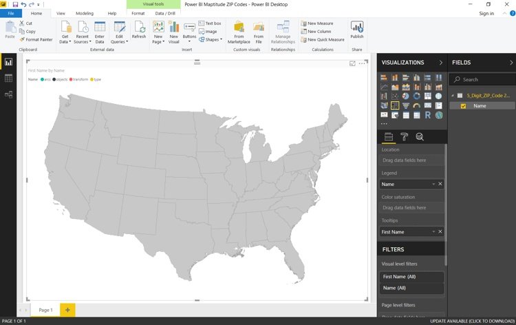
Power BI mapping map based on Maptitude state map

Home | Products | Contact | Secure Store
