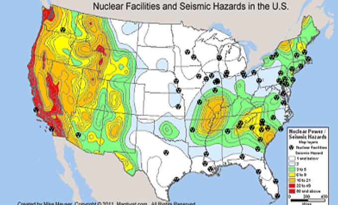
Derived from U.S. government sources, this map shows the proximity of nuclear reactors in the United States with their proximity to seismic hazard zones. More maps can be found here.
See more map infographics Learn more about Maptitude
Featured Maptitude Mapping Software Map: April
2011
Created by MapCruzin
Home | Products | Contact | Secure Store
