Mapping Software and GIS Glossary
A contour is an imaginary line that connects points of equal value. A contour map, also known as an isoline map, typically shows multiple contours such as elevation or temperature contours.
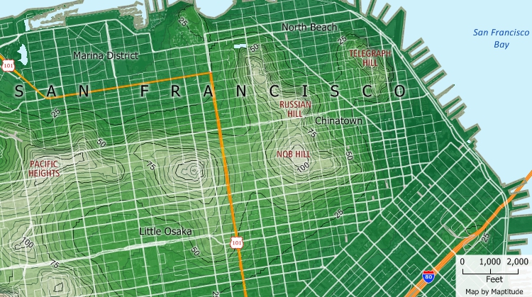
This contour map shows elevation contours. Hills are steeper where the contours are closer together.
Maptitude Mapping Software gives you all of the tools, maps, and data you need to analyze and understand how geography affects you and your business. Create contours for estimating elevations and performing visiblility analysis.
Learn More Free Trial Free for Students/Teachers
![]()
![]()
![]()
![]()
![]()
![]()
![]()
![]()
Home | Products | Contact | Secure Store
